Thursday, January 21, 2016

Giving it Welly in the Lavant Area

Saturday 16th January

Levin Down from north of St. Roche's Hill
Bright after a hard frost overnight.
Wearing new wellies, I returned to the Lavant area for a longer walk, taking in the upper Lavant valley to the north of The Trundle. 

As I'd done on Tuesday, l walked out to East Lavant along the Centurion Way, now according to 0S Explorer map, aka the Lipchis Way. l then walked up Chalkpit Lane towards The Trundle (aka St. Roche’s Hill), taking the path contouring around the south side of the hill towards Goodwood. Following the road eastwards alongside the racecourse, l took The Monarch's Way path off to the left, past the big piles of logs and down the hill towards East Dean. I meant to go to Charlton, but forgot to take the other path down the hill. thence the walk turning out rather longer than I'd originally planned. Lunch on a chilly bench on the green at East Dean. This faced the pond, officially the source of the Lavant, though it actually rises a bit east of there, a narrow stream running alongside Chapel Row and under the road (Main Road) behind me. A quick sketch, though not the weather for hanging around.

East Dean pond
Then walked to Charlton along the road, the widening Lavant stream running alongside on my right. Fair bit of clutter and car flappery when I got to Charlton, seemingly for the the pub on the far side of the road, which looked suspiciously like a gastro-pub. At the crossroads past the hotel, turned left and did a quick pencil sketch looking along the Lavant, running through the field towards Singleton. Levin Down across the road on my right. Then followed the path through the field to Singleton, a couple of big puddles in the centre of the field and very muddy at the far end where cattle had churned it up. From the Singleton church, took the path up hill towards The Trundle, coming out onto Knight’s Hill lane which met the Goodwood road by the car park. Awkward crossing of the Goodwood road to the path up the hill to fort. Limited visibility with the bends which some people can take rather fast. Though I’d been going quite well until now, slowed going up the hill, not feeling 100% (see below).

Towards Levin Down and Singleton from Charlton
Left The Trundle via the path westwards to Haye’s Down. In the field below Haye’s Down, the Lavant was looking pleasingly abundant, catching the late afternoon light. By now (about 3.30pm by the time I’d done my quick sketch), I was conscious of having quite a few more miles to go (about 5) with limited daylight (lighter than at the beginning of the month, though still dark by 5.00pm). After quick looks at the now relatively broad Lavant running through the fields from East Dean towards Binderton House (across A286) and Ox Barn. Kept the way back into the city simple, following the Centurion Way (even where not paved, mainly mud-free) to Mid Lavant. A pleasantly copious flow again where the Centurion Way crossed the stream. It now looked more like the sort of size river that might be expected to run along this valley; the Lavant being a misfit stream, too small for its valley. Perhaps in the distant past (probably Pleistocene or early Holocene), when the chalk escarpment of the South Downs would have been further north than it is now, a larger river drained this valley from the north, with the upper Lavant between East Dean being a tributary. As erosion cut the escarpment back southwards, exposing sandy layers in the Lower Greensand, it’s likely the Western Rother cut back and captured the upper reaches of the Lavant.

The view over the Lavant from Haye's Down

At the foot of Haye's Down

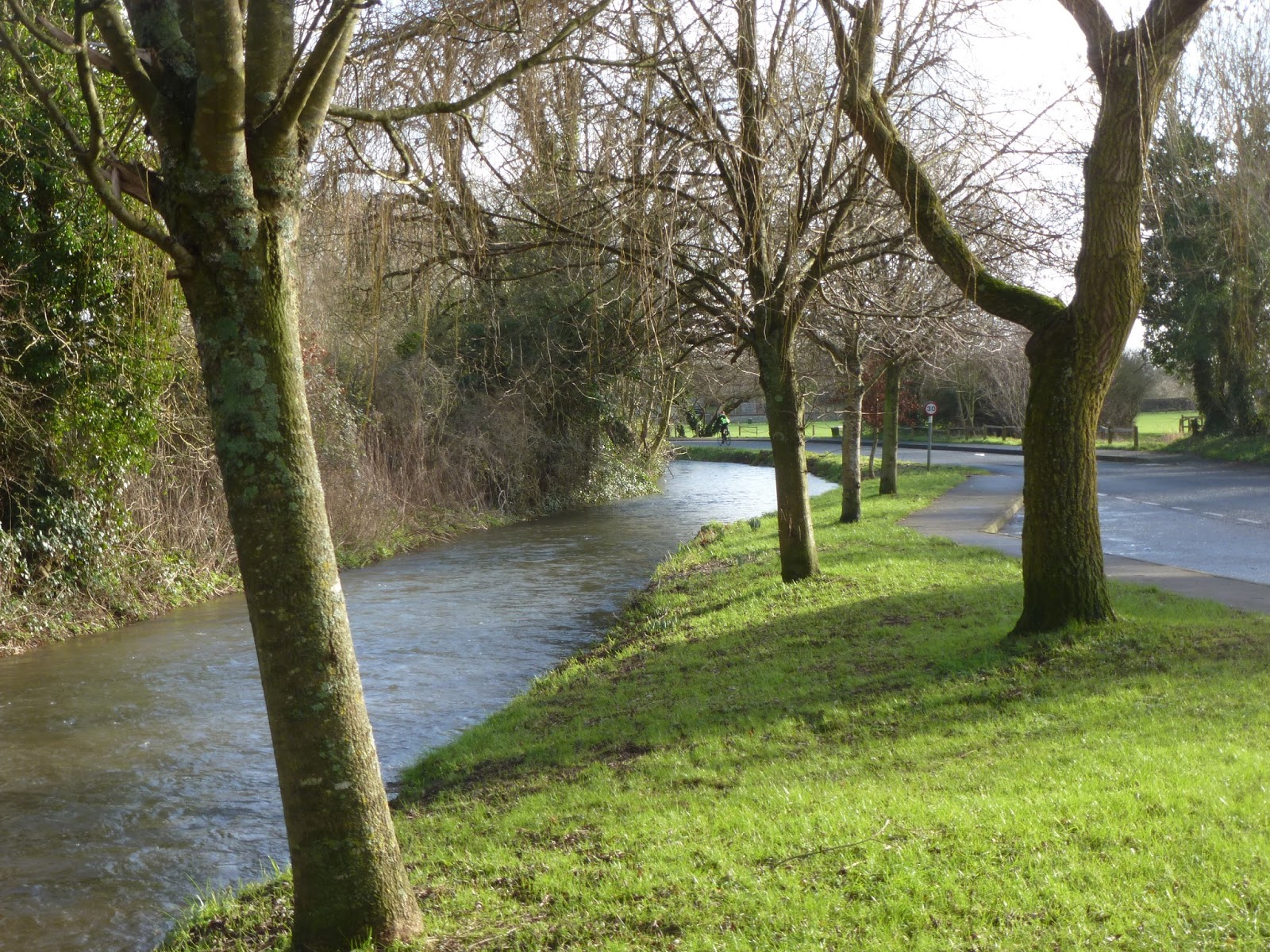
The abundant Lavant above Mid Lavant
Back in Chichester 5pm. Though tempting, time was getting on, so I didn’t linger for a coffee.

Actually, walking boots would have been more suitable, and more comfortable, given the length of the walk (about 15 miles) and the frost / ice lingering in places. This frost took the edge off the mud and the South Downs are easier wrt to mud than the clay soils closer to home, or The Hangers, though there were still a few muddy bits around Singleton. Mostly walked along tracks. 


Wednesday, January 13, 2016

The Lavant Runs Again...


12th January 2016 - Wind still westerly, but feeling very chilly in it, especially when cloudy / dark. Bright morning before clouding over around midday.

The Lavant re-emerges - Chichester south


Went to Chichester specially to see the Lavant, now flowing well after a late reappearance this winter. It was racing out of the culvert under South Street as if glad to see daylight again after its banishment beneath the city streets, the channel here still relatively confined. Plenty of water in all the diverging, constrained channels on the south side of the A259, too. It wasn't as high as it had been this time in 2013 or 2014. Water in the channel south of the cathedral and city wall probably about a foot deep.

I don't know exactly it returned, but a month ago it was still dry. What a change in a relatively short space of time. Last week the EA River & Sea Level’s page (Southeast – Solent and  South Downs, Graylingwell) indicated it was more than high enough to flood. The turn around has happened not just onthe Lavant, but also on rivers throughout southern and lowland England.

When I got home, I ordered some new wellies online (Blacks): a drought of wellies in the shops after winter sales and the general swampy-ness everywhere right now. After a succession of wet winters and our general area being especially bad for mud, l tend to wear through wellies fairly quickly (three pairs in as many years). Also walk longer distances in them the typical welly wearer might. My walk out and back to East Lavant confirmed they were no longer up to the job. Though no visible splits or holes in the soles or join with the sole, water still getting in somewhere when I tried walking through puddles, making my socks damp. Soles don't tend to be very thick either, meaning uncomfortable when walking along rougher, more flinty paths. /This was even though l avoided the soggiest / boggiest bits, by walking in /out of the city mainly along pavements to Brandy Hole Copse and then along the Centurion Way to Lavant.

A Centurion along the Centurion Way

At East Lavant, alongside Sheepwash Lane, again, not as high as it was 2 years ago, when it was brimming over. Now well within bank but fairly high beneath some of the brick footbridges leading to / from the houses along the lane and the bridleway north towards The Trundle.

East Lavant


Did a few sketches along the way;  because of the cold, I had to keep them fairly quick: hence pencil only south of the city wall, looking westwards along the path here to a red brick bridge. Along the Centurion Way, in the open area around the “amphitheatre” one of the “Centurions”, viewed looking north along the path to where it went under a road bridge. A pole in the centurion’s left hand. He’d also acquired a scarf (handkerchief), removed by the time I came back this way. Then, thirdly, looking along the Lavant from the road bridge at the east end of Sheepwash Lane, for comparison with the one I did here a month ago when the channel was dry.


East Lavant - 12th December 2015

East Lavant - 12th January 2016
After packed lunch on a bench on the edge of the green, as sheltered as possible here, tried walking along the bridleway across Sheepwash Lane alongside Staple House Farm. Once again, only got so far, because wellies weren’t up to the petite crue (puddle) with no way round either side.

The big downer / feel awful factor hanging over the Lavant - the stream and the village is the prospect of having a thundering expressway rammed through it (revving up the A27 /Chichester northern bypass. Blogged about this last month. A downer certainly for someone like me who has become very attached to this place, as intermittent as the Lavant may be. There are no firm proposals or decisions yet on possible options, however a northern bypass is one of them. As at Arundel, there are people who seemingly hell bent on going for the most environmentally destructive option. It would be far more sensible to improve the pre-existing dual carriageway to the south of the city instead of intrude into the South Downs National Park and wreck the relative peace and quiet to the north of the city. East Lavant would, at the very least be have considerable traffic noise and poorer air quality inflicted upon it, even if  they road lay out in the village was left much as it is now. It is great, too, to be able to walk out from the centre of Chichester to the South Downs without having to negotiate a potentially dangerous road crossing. Anyone who has walked the ridge of the Downs via the South Downs Way or Monarch’s Way will know that there is a tricky road crossing  about every ten miles, if that.  As is the case when attempting to walk out to Chichester Harbour from the city centre.

These are the first few key facts, pasted from the Chichester Deserves Better homepage:

  • Highways England are considering 6 options to improve congestion on the A27 around Chichester.
  • 4 options are improvements or upgrades to the existing route.
  • 2 options are a northern bypass that will pass through Fishbourne, West Broyle, Lavant, Goodwood, Strettingon and Boxgrove.
  • It has been confirmed that the bypass will be an Expressway meaning it will be a dual carriageway with national speed limits.
  • The route would run along the boundary of the South Downs National Park causing irreversible damage.