Tuesday, May 30, 2017

Spring Low Down 2017

After the largely dry autumn and winter,  in which no effective rainfall fell in many areas of southern England until January according to the Environment Agency, spring came early and turned the screw, especially the very dry April.

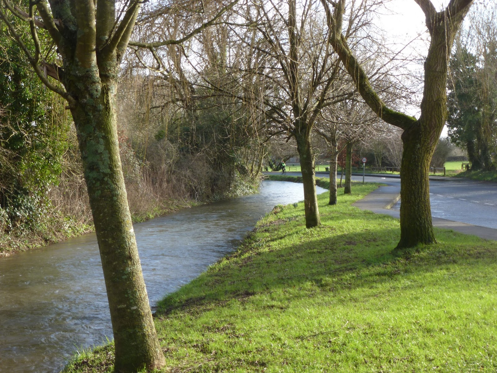
The dry River Lavant near West Dean

March saw significant rainfall in northern England, but this didn't benefit the south. As soon as the rain stopped, river levels fell quickly. Early April was dry and very warm, the rest of the month was dry and cool with strong winds. We had no rain here in south Hampshire until the end of the month, 30th. This was the case in many parts of Britain. If it hadn't been for that day's rain, the monthly rainfall totals would have been even lower (see links to Met. Office monthly statistics and news releases below). The mild, early start to spring in March and abundant sunshine meant plants grew quickly, as did the rate of evaporation. By the last week of April, soils were bone dry and cracking and patches of brown grass were appearing. This brought an end to groundwater recharge, which had been inadequate during the crucial winter season anyway. River levels, including normally more stable flowing chalk streams fell everywhere. In most parts of the UK, gauged flows were either below normal or at the very low end of normal as if it was late summer (see links to relevant Environment Agency and CEH reports). In eastern and southern England, demand for water increased sharply as farmers were forced to begin irrigating crops much earlier than they'd usually expect. The situation across the English Channel was much the same, or even more entrenched, according to Eaufrance (see links).

According to the Met. Office, the monthly total for the UK in April was 47% of the long term average (1981-2010).  The total up to 19th April was just 26%. The best case was Scotland, with 71%.

A brief May Day respite from the high pressure, Emsworth, 1st May
May began with the customary cool wet / showery Mayday public holiday. I went to Emsworth and looked round the Art Trail. The rain was mainly showery and confined to about a couple of hours during the middle of the day, with sunshine between the showers. After so much dry and preferring cooler / mixed weather to clear skies and relentless sunshine, I took real pleasure in the lull as I sketched around the harbour.
Dry paths above Salisbury Crag, Edinburgh, 11th May

Bank hols over, normal service resumed, with high pressure setting in yet again, though this time, it was to the north of the British Isles, meaning that the warmest and driest weather was in northern Britain. For much of May, we were in Scotland. Being cool and breezy back home, the warm, generally very sunny weather in Edinburgh caught me out (9-11th May). The soil was at least as dry as it was back home and the grass in Holyrood Park was looking very brown. As I looked down onto the paths above Salisbury Crags, they reminded me of a network of dry rivers in a desert. My 45 litre rucksack was bursting at the seams partly as I was having to carry my layers of clothing rather than wear them. From Edinburgh, I moved on to Stirling (11-13th May). There, I visited the River Forth: Stirling Bridge and the view of the very sinuous river from the Wallace Monument. As noted in 7Squared Goes Forth it was very tidal. On the Friday afternoon, I chanced upon some shortlived tidal turbulence as the flood tide rushed in at Stirling Bridge on the Friday afternoon. While I was at the top of the Monument, though, it was about low tide and the river in the nearer distance shallower than paddling depth, with dry shoals of gravel exposed. Not knowing the area, I couldn't tell how much of this was tidal and how much due to low fluvial flow, but the burns I glimpsed in the Scottish Central Belt all looked fairly low.

The River Forth from Wallace Monument, Stirling.
"Exceptionally Low" in May
Another wet interlude began on 13th May as I left Stirling, meeting up with my Cycling Man for a fortnight in Perthshire, based in a cottage on the northeastern shore of Loch Tay. The weather that fortnight was more mixed, with rain over both weekends - I watched the latter part of the Caledonian Etape in Glen Lyon stood under golfing brolly kindly lent to me by one of the marshals. It was generally, though very warm, especially during the second week. The last two days in the mid-twenties (celcius) and warmer than back home. It felt uncomfortable, and more so than the same temperature would do back home. I put that down to the mountain-glen topography, higher humidity and the notorious midges. The latter weren't as bad as I'd dreaded they might be. Some years / some areas they can be out and biting in mid-May and we both have very sensitive skin. Though we were lucky this time, it felt as if they were on the cusp and when the time came to head home (27th May), there was a real feeling that we were getting out just in time.

The main issue was, in common with so many otherwise comfortable / well designed buildings around the the UK, the cottage wasn't built for comfort in hot weather. All along the main wall, large windows and doors out to the decking, making for great views along Loch Tay. The southwesterly aspect and long light evenings in the north meant that the sun streamed in from 12 noon until it dropped behind the hill at around 7.30pm. Though pulling the curtains cut down the light and the glare, the heat built up in the building, clearly not insulated against the heat. Luckily back home our main room is relatively cool.

Despite all the other stuff going at the time,  the dryness caught the media's notice in mid-May, reflecting farmers' concerns about crop yields about the lack of rainfall and its potential impact on crops, especially cereal crops and the apple harvest. In the printed edition of The Guardian - page 11, 13th May, the poster river here was the upper River Eden at Appleby-in-Westmorland. The photos contrasted its healthy during the Appleby (gypsy / traveller) horse fair in early June 2015 with the trickling flow this spring. When I looked at the river level here (EA - Rivers and Sea Levels), 13th May, it was just 9cm deep (low end normal range 25cm). At Carlisle (Sheepmount) it was down to 0.53m (low normal 0.65m). There was some pick up here after the rain on 13th, 14th May, the level rising about 20cm at both sites, then it quickly dropped again.  Usually, its its notorious floods which make the headlines, but it is a notoriously flashy river with a roller coaster regime, the full flow range being from about 5 - 1700 cumecs (cubic metres per second).

Loch Tay, Kenmore, 17th May
North of the Border in Perthshire, meanwhile, I thought the Loch level at Kenmore (the outflow of Loch Tay) looked low, with tree roots exposed high and dry on the shore - see Perthshire - Loch Tay and Around and the Tay subdued - see The River Tay - Perth and Dunkeld. I wondered if canoeists and white water rafters heading to the Grandtully rapids (below Aberfeldy) might have been disappointed. I wondered how much there would be to see at the Falls of Dochart (the Tay by another name above the head of Loch Tay) at Killin and on the tributaries. The Tummel below the Pitlochry dam certainly looked lower than it had been last year. The Falls of Dochart were probably down to their late summer level, nonetheless, I was pleased that there still seemed to be plenty of water coming over the falls to enjoy and sketch. I also sketched waterfalls above Fortingall in Glen Lyon. The River Garry in the gorge below Killiecrankie looked low but reasonable and there was still water to see at The Soldier's Leap. As we learned at the new Pitlochry dam visitor centre and exploring around the Lawers Dam between Glen Lyon and Loch Tay, the regime throughout the highland River Tay is heavily influenced by hydropower. There is the Loch Tummel scheme above Pitlochry and the Breadalbane scheme in the Loch Tay-Glen Lyon area.

Lawers Dam hydropower reservoir, Perthshire,
26th May
The reservoir above the Lawers Dam was almost empty, though one of the key things with these schemes is the network of aqueducts and pipelines which enable water to be transferred between different catchments, eg from Loch Garry to Loch Ericht. See: 

The Met. Office say that it was the second warmest May in the UK in a data series beginning in 1910, the first being May 2011. It was the warmest on record in the Central England Temperature series which began in 1659; and the warmest on record in Wales and Northern Ireland (Met Office, 2nd June). The May rainfall for the England was about average (Met. Office 1981-2010 average). In southern and eastern England it was above average (130% in some areas), mainly falling during the second half of the month, the 17th being particularly wet, apparently. As usual in late spring, though, this was ineffective in recharging aquifers or mitigating the rainfall deficit which has built up since last summer. because of the high rate of evapo-transpiration in warm weather and plant growth at full pelt. In Scotland, monthly rainfall was only 68% of average. In most parts of the UK, the rainfall deficit since last July, was at least 10% at the end of May. Soils dried out in most areas. 

The EA and CEH's river flow maps for index rivers in England and the UK respectively show most rivers running below the norm expected during April and May (record lengths vary at different gauges, but all have data going back at least 40 years).. Particularly in northern and western areas, the hydrographs traced well below the line (long term average) during April and May. Many rivers were down to less than half. Six rivers in northern Britain were ranked as exceptionally low in May (red on the maps): the Tyne at Bywell (just 30% LTA). The other five were north of the border, confirming my impressions on holiday. They Tay was down to 40%; both the Spey and the Forth hit new lows (mean daily flow rates). 18 UK rivers around the UK were notably low (orange), including the Severn (Bewdley, down to 39%), a river in high demand for water abstraction; the Dorset Stour; the Great Stour in Kent; and the Salisbury Avon. The Itchen, a chalkstream was among those ranked below normal. The hydrograph for the Highbrook and Allbrook gauge has traced below the (LTA) line since last October. The more flashy (responsive) rivers in parts in SE England seemed to benefit from the rain later in May, eg the Mole and the Medway.  The river flow map for July 2016 - end May 2017 reflects the rainfall deficit accrued since last summer throughout the UK, with 9 rivers ranked as exceptionally low, including the Spey and the Dart. 19 were notably low including the Severn, the Welsh Dee, the Medway, the Great Stour the English Tyne, the Tay and the Tweed. The Thames was below normal. The Itchen was among only 8 on the map ranked in the normal range (green).

River Mole, The Stepping Stones
beneath Box Hill,
7th June

Rainfall during the first week of June (5th, 6th) brought a temporary pick up in flows on responsive rivers in SE and NW England. The Mole was flowing well when I saw it beneath Box Hill on the 7th, and across the Sussex watershed, the Arun at Pulborough showed a similar rise superimposed on its tidal flow. After running low in May, the Eden at Appleby and Carlisle returned to its normal flow range, though the Sheepmount gauge seems to have been playing up and giving spurious readings lately (EA River and Sea Levels). The Severn (Bewdley) responded more slowly. By mid-June, though, levels were dropping again. My energy and mood seemed to reflect these trends, independently though sympathetically: early June, energised after our Scottish trip; relishing the fast changing skies over Emsworth on the 6th; then dropping again during the second week of June as temperatures rose. 

Looking ahead to the summer during what's so far been a very warm, generally dry year, a trivial point I know compared to most things going on in the wider world, but when talking about hot weather, it would help my flow and wellbeing if weather and news people could acknowledge that hot weather isn't for everyone. I.e, less of the "we are enjoying a heat wave", "the nation is enjoying temperatures in excess of 30 degrees" and "the people have spoken and they like it hot".

Links / References

Met Office News releases / blog:
Dry weather in April

April 2017 UK weather statistics (temperatures, rainfall, sunshine hours) -
Long term average 1981 - 2010, records from 1910.

CEH monthly hydrological summaries for the UK:
CEH National River Flow Archive (gauged flows and hydrographs):

Environment Agency - weekly and monthly Water Situation reports for England and English regions including soil moisture, river flows, groundwater levels, hydrographs at various river gauges and groundwater wells.

Environment Agency - River and Sea levels around England for the past few days: https://flood-warning-information.service.gov.uk/river-and-sea-levels

Ditto Wales

SEPA - ditto Scotland

Eaufrance - monthly summaries for France
Vigicrues - gauged river levels and flows on French rivers

My blogs:
My artwork - http://artywater.blogspot.co.uk/2017/

Sunday, April 9, 2017

Spring on the Wey 2017


Friday 7th April -  A stroll along River Wey (Wey Navigation) from Guildford town centre, through Millmead, to St. Catherine’s Lock and as far as the road bridge at Shalford. It was a very warm afternoon, with strong sunshine from a cloudless, anticyclonic sky. The willow trees along the river bank upstream of Millmead were coming into leaf. Everywhere, there was lots of greenery.  This greenery was restful greenery, and much easier on my eyes than the glare off tarmac, concrete surfaces and buildings in this sort of weather. That said, the larger trees alongside the car park facing the Yvonne Arnaud Theatre and Debenhams were pollarded and now looked very bare. Marsh marigolds in water meadows beneath St. Catherine's Hill. Marsh marigolds flowering in the wooded meadow on the SE side of St. Catherine’s Hill. There wasn't, though, much shade in the  open area between St. Catherine’s Hill and the railway bridge upstream, walking south past St. Catherine's Lock. 

A narrowboat called Weyout moored in front of the old lock keeper's cottage just below the railway bridge. 

Back at Mill Mead, sketched in the shade of the willows opposite the busy pub garden on the far side. Reflections in the river. I tried sketching them, though didn’t really have the right materials and I got lost in the detail. Nextdoor to the pub, on my left, a tarted up boathouse painted in white and turquoise green. Two blue canoes stood end on to one side, adding to the reflections.

Nextdoor to this, Guildford Boathouse was now seemingly closed; boarded up; and generally looking in a very sorry state. A tired Hoeseasons sign on the wall facing the canal. I don’t think I’ve been here for a couple of years and before then I hadn’t noticed. I don’t know, then, how long it’s been like this, the past couple of years, perhaps?  At one time, you could do boat trips in narrowboats from here, as in summer 1982, with my cousin over here on holiday. Before then (1970s) I think there were some to Godalming as well (an early primary school assembly in which one of the other classes read out their story of the boat trip they'd taken to the rest of the school assembled in the hall “Steve opened a window, Shaun got wet…”. Much later on (early 1990s) I tried out the rowing boats with Guildford YHA Group, though I wasn’ t very good; or not according to the little boy in the boat with his parents,  “ Dad’s better at this.”, or similar. Until now (past 2-3 years) all the rowing boats were moored just upstream of Millmead Lock. But none today. If it has all been allowed to fold, that’s a big shame. It was busy in the Millmead area this afternoon and in the warm sunshine they could have been popular. All the more at the weekend.


Before heading for the train, a cuppa on Debenhams terrace. A couple of mums on a nearby table mentioned the Yvonne Arnaud Theatre being flooded one year. This probably would have been September 1968, which (despite major flooding in 2000 and winter 2013/14) are probably still the worst floods in the southeast in living memory. I don't think the theatre flooded in winter 2013/14.  In February 2014, I sat in Debenhams cafe looking out to a view of a flood, one of a succession that winter. See my blog notes from that period. Amid amid the prevailing weather now, all that seems a very long time ago. I thought the river now looked a bit low, certainly for this time of year.

My father, out painting at Waverley Abbey today (his peace disturbed at one point by a toy drone) begged to differ. He thought it looked fairly high. After a dry, warm week, I'd have thought that unlikely. I gather they adjust the water downstream of Godalming with sluice gates to keep the Wey and Godalming Navigations topped up, but it looked lower than normal where the Navigation and river ran as one channel (below Millmead Lock). I took some reference photos, including from Debenhams and the Danger sign on the bank just below the footbridge at the foot of the High Street. This sign partially submerged in February 2014. 


The Environment Agency's webpage giving the river level at Guildford read 1.24m, Sunday April 9th, 3.39pm. The EA say this is in the normal range, though it is at the lower end of it (1.10m). Probably, as the French would say, estival, ie more like what would be expected during the summer.

This reflects the largely dried winter - one February's rainfall was up to the long term (1981-2010 UK and regional) average according to the Met.Office. At least in southern England, spring got going with avengence. Now the trees are coming into leaf, it's pretty safe to assume the recharge period for 2016/17 is over. A long hot summer ahead if the synoptic pattern stays anticyclonic.

Warm, dry weather like this in April is not unusual, (eg 2014, 2011 and 2003). The spring of 2014, though came after a much more reassuring recharge season than the one we've just had. That spring was tough on the Mole (next river eastwards), though that has a much more impermeable catchment, its flow dominated by surface run-off, as with the northern rivers and most of those in central and western France. The Wey's flow has a high proportion of its flow derived from rainwater which has percolated through the ground, ie baseflow.  Normally at this time of year,  that should be comfortably topped up for the net evaporative season (April - October). Chalkstreams such as the Itchen and Test are even more baseflow-dominated (upwards of 80%). Dry winters such as the one we've just had aren't so good here. Two or more successive dry winters are worrying. A lucky escape in 2012, when weather changed for the wetter in April. 

I worry, though about a repeat of the largely dry period 1988-92. During this time period, there was intense rainfall and floods during winter 1989 /90 including Burn's Day storm, January 25th 1990. That winter, too was followed by a warm, dry spring, then a hot dry summer. It was the successive dry winters in 1988/89, 1990/91 and 1991/92 that really took the toll on the Wey and the Wessex chalkstreams. People wondered if the Lavant would ever flow again. 

Given growing awareness (though disappointing lack of action) of climate change at that time, I feared this regime becoming the new norm. Since then, part or all of  Britain and western Europe have had a mix of very wet winters (eg 2000/01, 2013/14, 2015/16) and dry ones (1995/96, 1996/97, 2005/06, 2010/11, 2011/12, 2016/17). However, my perception, certainly in southern Britain, has been of generally early, warm, dry springs; later, warmer, drier autumns chopping the winter recharge season from both ends. The rainfall patterns have seemingly reflected blocked synoptic patterns. Prolonged spells of dry weather lasting months on end have been punctuated by a bursts of full-on intense rainfall which invariably leads to flooding (recently and notoriously winter 2015/16 in northern Britain). 

---------------------------------------------- 


Among the many varied, vibrant exhibits at this year’s AppArt Exhibition and Sculpture Trail at Priors Field School near Godalming was a handmade book by Alyke Thorpe about her Short Wandering along the River  Wey, several decades of walking along the river with various generations of staffy dogs. A recycled hardback book filled with her photographs of the river and dogs, her embroidery, collage. 

Tuesday, March 7, 2017

No Business with Flow Business on the River Lavant

It was a showery day when I walked on The Trundle on the South Downs near Chichester on Saturday 4th March. The back half of me, facing into the weather, got soaked as I walked up the hill. The sun came out again as I walked up the hill and dried off. I sketched on the north side of the hill, the brick hut near the masts sheltering me from the chilly westerly wind. As I walked back into the city centre, the sky darkened again as showery clouds rolled in; though the rain held off until I was on my way back home. These showers came with at least a temporary shift to more unsettled weather, with the low pressures taking a more southerly track. Good for rivers whose flows are predominantly dominated by surface run-off after rainfall. For groundwater, and groundwater chalk streams, however, this could be too little too late. Certainly for the Lavant: I found it still dry, but for a few puddles as I walked through East Lavant. There may yet be some flow if and if and when the rainfall during late January and February percolates through the soil into the chalk to raise the water table. If so, it's likely to be meagre and brief: groundwater levels are still well down after the dry winter and the window of opportunity for recharge is now closing. Weeds were beginning to grow in the riverbed. Daffodils were flowering along the bank in Sheepwash Lane, showing spring wasn't waiting. 

According to the monthly hydrological summaries published by the Environment Agency and the Centre for Ecology and Hydrology, groundwater levels in the Compton House and Chilgrove House wells (both near Chichester) were respectively at their 7th and 13th lowest levels in 122 and 181 records at the end of January. The level at Chilgrove was lower than it was at the same time in 2012; the last winter no-show of the River Lavant. That came after two successive dry winters. The subsequent pick up and about turn in water fortunes which came with the wet spring was very unusual. To assume it will happen again this year is wishful thinking. This entrry illustrated by photos from East Lavant (4th March), together with subsequent doodles involving daffodils, dipsticks and dowsers.


Readings on Water - Spring (Springs)

Tim Bradford, The Groundwater Diaries, paperback (2003). 

I picked a copy of this up about a year ago in Kims secondhand bookshop, Chichester, though only started reading it at the beginning of this month. I was expecting something fairly straight and conventional about the groundwater under London (in the Chalk, beneath the younger Palaeogene layers of London Clay etc); references to occasional flooding of subways (like the Exhibition Road-South Kensington tube station one) when the water table is high; or something about the lost (buried / banished) rivers such as the Fleet on the lines of Nicholas Barton’s The Lost Rivers of London. The book is indeed about lost, buried rivers, though the take and tone of the book is completely different from what I’d expected – in a good way. The subtitle should have give me a clue, Trials, Tributaries and Tall Stories from beneath the Streets of London. The overall tone is witty and, in places, surreal. Compared to my readings on water earlier this year, it’s light relief for spring (in both senses of the word). There are illustrations on about every other page with the author’s sketches and cartoon drawings. Some of them would have benefited from being bigger, though they were generally sharp, especially considering the lower quality of production (slight yellowing of the paper). I started reading it to read myself to sleep after an evening meeting which went on a bit. Instead, it had the opposite effect, laugh-out-loud. I only stopped when my Literary Man wanted lights-out ahead of his busy day involving meetings dragging on a bit. 

First came the lists of contents and illustrations which intrigued me as to what was to come, and made me laugh: among the illustrations listed: A Danish farmer’s punk crossover; Algae Scum kicks Rupert’s head in; Special Brew Dowsing; and who are The Littlehampton Boys (page 135)? In the first chapter a little known, “third rate” punk album is floated in a Lincolnshire river to placate it after a flood in the early 1980s. Flowing on from this, speculation about the album heading out across the North Sea and sparking off a Danish punk movement. Subsequent mentions of a famous eighteenth century painting; the powers of Special Brew beers / lagers in aiding perception and one-ness with subterranean rivers; Arsenal FC / football in relation to rivers…

As of the first week of March, I’m up to about page 100, in the midst of a pub crawl along the valley of the buried and sewered River Fleet. The Fleet is the largest and most famous of the lost (underground) rivers of London. Others include the Tyburn, the Quaggy, the Effra. It seems from this that there are numerous other smaller ones, too: among the Ching (sounds like a till or  stereotypical 1970’s English bloke's stereotypical picture of the Chinese) and the ostentatiously named Moselle (I thought there was just the one in flowing into the Rhine at Koblenz). In the appendices at the back, a “Highly scientific diagram of flow rates”, the units of measurement , much simplified, ranging from A few puddles to Raging torrent .
The author would have been his early to mid-thirties (as I was) around the time of writing. He admits to being a river obsessive, Come and see my etchings of tributaries of the Tyne. Good to know I have a contemporary kindred spirit out there. He was writing, then, about the London of the 1980s, 1990s and very beginning of the 2000s, so lots has changed since then. The rivers are still buried, though above them, much more building work; the high rises; and of course the 2012 Olympic Park area around the lower reaches of the River Lee.


PS - I’ve just spotted a Wanted poster near the very end, on similar lines to my Lost Lavant posters. We came to these completely independently, albeit via through inevitable idea-flow running along lost rivers.

Wednesday, January 25, 2017

Readings on Water - Winter


Non-Fiction - Tristan Gooley - How to Read Water (hardback 2016)
Starting from puddles on muddy downland paths to ocean waves. Text supported with some good colour photographs, including some of very familiar stretches of water such as the River Arun. The author lives in West Sussex.

Fiction - Barney Norris - Five Rivers Met on a Wooded Plain

This is set in Salisbury, with five rivers flowing and converging in the area: the Avon, the Nadder, the Wylye, the Bourne and the Ebble. First and foremost, it is not a geographical or hydrological guide to the area. Neither is it an easy going story about five easy going chalk streams. Instead it a confluence of people: five people living in the area whose lives intertwine. Their lives much more turbulent than the courses of the rivers flowing through the area. It is one of the most emotionally intensive books I've read, full of grief, sadness, loss and regret; something I'd been forewarned about by my Literary Man who'd read the book not long after it was published in hardback last year. Being wary, yet curious because it was set in a city we visit regularly, I gave it a try in January. I was almost reduced to tears at times, especially the school boy having to confront the biggest fear I'd had as a teenager and young adult; the army wife dealing with loneliness and depression; and the farmer who couldn't face going back home after everything one particular day in May had thrown at him. Yet, even with all the swirling currents of emotion, it had me hooked. I tend read at bedtime, and usually it's head drooped over the book in a dose after a couple of pages (me, not the book), but not this one. It is powerfully written, with some good river analogies along the way: I liked the one about the "oxbow lake" family. Norris puts across the sense of place well, too, setting the scene in the first chapter, beginning with the formation of the river valleys and Britain as an island. Then a brief history of Salisbury from Wood Henge, Stone Henge, Old Sarum and the present Cathedral with the tallest spire in England (red light at the top for planes). We pass through Market Way, past the library, when parking in the large car park in the city centre, walking towards the square. I've sketched the view from Old Sarum quite a few times now. Beyond the Avon and Nadder between Stratford-sub-Castle and and Hardham, I don't know the rivers very well. This is partly because of the drought of public rights of way along them (and most chalk streams). Salisbury is also a convergence of a number of busy A'roads meaning awkward, tricky crossings when trying to explore the area on foot. As with the people in the story, there's a look at the OS Explorer map (1:25000) shows convergence, together with intertwining of waters. Rivers split into one or more channels to feed mill streams and water meadows. In between intricate networks of water meadows drainage channels, especially along the Avon downstream of the city. This is something I've been completely unaware of at ground level.

Non-Fiction - Rachel Lichtenstein - Estuary - Out from London to the Sea (hardback 2016)
Other than vague memories of crossing the Queen Elizabeth toll bridge enroute to East Anglia and even vaguer memories of visiting a great aunt living near Southend during the 1980s, I know very little of the tidal Thames downstream of the Thames Barrier. This engaged read went some way to filling these gaps in my knowledge. It is illustrated with photographs, though compared to Gooley's book, the quality and clarity is disappointing. Captions would have been helpful too. Thankfully not so for the maps printed on the endpieces, beyond perhaps the seven-squared reader's spectacle upgrade being overdue for reading the small print labeling of the treacherous channels and sandbanks in the outer estuary. Not knowing the area well, I found these essential for pinpointing the locations of the people and places encountered. The book covers the estuary from the Barrier eastwards, also taking in the north Kent coast, the Medway; Foulness and the Blackwater estuary to the north. It all begins with a trip on a Dutch barge out from London in 2011. It had to be cut short, though not before a very unsettling night moored at Southend Pier. The story Lichtenstein told of that reinforced the thoughts I've had along the Thames from time to time of the river being haunted by its very eventful history, especially in London and along its lower reaches.

Flowing on from this read, a move north to the Blackwater estuary for:

Fiction - Sarah Perry - The Essex Serpent (hardback 2016)

Was the serpent real or imagined? Certainly a sense of something creepy and unsettling seeping out of the estuary: an induced hysteria. With everything going on around the time of reading - giving me the general feeling that it wasn't just the winter weather stuck in a blocked pattern but everything everywhere, this atmosphere felt timely. It is set during the late nineteenth century, referring among other things to Mary Anning at Lyme Regis, the 1884 Colchester Earthquake, contemporary medical knowledge.

They say, don't judge a book by the cover. As with Lichtenstein and Norris, I'd had this recommended to me by my Literary Man. The story did not disappoint, though surely the cover with its strong blues and golds would have drawn people in. In January, Waterstones had it displayed prominently on their shelves. The endpieces inside attractively printed, too. It went to show that reading a well produced book is much richer and engaging experience than the equivalent electronic book via a Kindle or similar. I have a Kindle, though now almost exclusively for the OED and foreign language dictionaries here. The downloads don't come with a striking cover and tend to be rubbish for any illustrations.


Friday, January 13, 2017

Two Contrasting Winters

During both winters 2015/16 and 2016/17, the weather over the UK and much of continental Europe reflected the North Atlantic Jetstream being stuck in more or less the same position for weeks or months on end.  Winter 2015/16 was marked by a succession of low pressure systems passing over / close to the British Isles, bringing strong winds and truly exceptional rainfall particularly during the late autumn and early winter. Autumn 2016 and the early winter 2016/17, by contrast, was calm, often bright and generally very dry, especially December. This reflected a persistently very anticyclonic (high pressure) pattern. Notes on both winters below:

2015 / 16


In the Met. Office's first year of asking the public to name storms (low pressure systems bringing strong winds), eleven named storms affected the British Isles between early November and late March.  There was major, widespread flooding in northern and western Britain, with some exceptional outflows and river flows.

For my notes on the flood events of winter 2015/16, please see:

Rain and Flood Fury in the North , published 10th December 2015, written after the first round of major flooding in northern Britain, most notably Cumbria for the third time in little over ten years.

Difficult Confluences in the North, published 27th December 2015, written just after the Christmas 2015 floods, hitting the north yet again, most notably this time Yorkshire.

Flood Reports

1. Barker, Lucy; Hannaford, Jamie; Muchan, Katie; Turner, Stephen; Parry, Simon. 2016 The winter 2015/2016 floods in the UK: a hydrological appraisal [in special issue: The exceptional winter of 2015/16 in the UK and Ireland] Weather, 71 (12). 324-333. 10.1002/wea.2822

2.
  1. UK Winter 2015/2016 floods report published | National River Flow Archive

Marsh, T.J.1, Kirby, C.2, Muchan, K.1, Barker, L.1, Henderson, E.2 and Hannaford, J.1  2016.  The winter floods of 2015/2016 in the UK - a review.   Centre for Ecology & Hydrology, Wallingford, UK.  37 pages.
Affiliations:  1Centre for Ecology & Hydrology; 2British Hydrological Society.
ISBN:  978-1-906698-61-4

Both reports give a comprehensive appraisal of the UK hydrology (river flows, run-off, groundwater, soil moisture) and the weather (rainfall) influencing it. Data from the Met. Office, Environment Agency, SEPA, Natural Resources Wales and the UK, the Centre for Ecology and Hydrology,  National Hydrological Monitoring Programme, UK National River Flow Archive. Both reports are publicly available online.

Key points:
The rainfall in northern and western Britain in November and December was truly exceptional. December 2015 was the wettest of any calendar month in the UK, in the Met.Offices's series going back to 1910. It was the second wettest winter (December - February). A new daily (24) hour rainfall record at Honister Pass, Cumbria 5/6th December, 341mm, breaking the previous record of 314mm at Nearby Seathwaite in November 2009.

This came after a sharp turn around in rainfall and river flows in November 2015. The early autumn (September and October) was relatively dry, with many rivers running below average for the time of year. Heavy rainfall through November rapidly saturated soils, meaning run off into rivers was subsequently rapid, especially in northern and western impermeable catchments.

Some impressive, record breaking river flows were recorded at gauging stations in northern and western Britain. However, records generally go back to the 1950s and 1960s, therefore representing a relatively short timescale. Flows are likely to have been higher during the historical past.

New peak flow records / notable flows:
During the Storm Desmond floods, 5-6th December, the Eden, Tyne and Lune all peaked at around 1700 cubic metres per second, the highest of all being the Lune at Caton, all the more remarkable considering it has a smaller catchment than the other two. These are the highest flows recorded on any river in England, and among the highest in Britain. They reckon the flow on the Tyne was the highest since the great flood of 1771, though that was estimated to be nearly 4000 cubic metres per second.

As well as the above, the Tay, Tweed, Dee in NE Scotland and the Ribble all attained peak flows of at least 1000 cubic metres per second. The Tay, at Ballathie in central Scotland has the highest flows of any British river, it's highest recorded peak flow was in excess of 2000 cubic metres per second in the January 1993 floods. Though it didn't get that high this time, the peak flow in early January 2016 was around 1800 cubic metres per second; and daily flows were 1000+ cubic metres per second on eight days December 2015 - January 2016.

Total outflow (run-off) from all rivers and lakes in Britain is useful for comparing flood events. A 24 hour new record was set 5th/6th December 2015, exceeding the previous one in December 2006 by a large margin. 6th, 26th, 30th December 2015 all in the top 24 hour totals. The winter also ranks high when run-off is measured over longer periods, of up to 90 days.

The Eden (right) and Caldew (left) at Carlisle
in the calm of the early autumn
(September 2016)
During the drier weather of the spring and early summer, water levels on some of the above notorious rivers fell steeply: the Eden (Sheepmount, Carlisle) registered new seasonal flow minima in May and June, on 19 days, and a consecutive 12 days.


Anthropogenic climate change is a likely aggravating factor, potentially changing rainfall patterns, melting Arctic ice possibly slowing down the jetstream, making blocked weather patterns more likely. As well as being exceptionally wet, December 2015 was also exceptionally mild, with daffodils flowering in southern England before Christmas, highs of up to 17C in southern England / the Midlands, more like April. However, this is superimposed on the high natural variability of Britain's weather. This variability was demonstrated during the contrasting winter which followed.

2016/17

Calm weather beneath and anticyclone, Chichester Harbour 27/12/16
Autumn 2016 and the early winter 2016/17, by contrast, were calm, often bright and generally very dry. Up to the first week of January 2017, there were only three named storms five as of the end of February. This reflected a persistently very anticyclonic (high pressure) pattern. For much of the winter, the low pressure systems passed well to the north of the British Isles, over Iceland, in line with a meandering jetstream looping up into the Arctic and down again through Russia and eastern Europe. To the south and west of it, an extensive tongue of high pressure encompassed the British Isles and much of continental Europe, stretching from Scotland to the Mediterranean. This is what meteorologists call an omega block. In December some of these anticyclones were intense, with central pressures upwards of 1040 millibars. Of the three low pressures which touched the British Isles, two of them, Storms Barbara and Conor around Christmas 2016,  passed to the north. Only one, Storm Angus in November, brought notable rainfall, albeit with flooding and flood warnings, to southern Britain and France as it tracked to the south, along the English Channel. The good news: other than Storm Angus, the winter was been largely flood-free, following a bright autumn with strong leaf colour persisting well into November. During December 2016 and early January 2017 there has been a good deal of dry and bright weather, making for crisp, cold frosty days, fine sunsets over our local coast and plenty of winter sunshine. Walks have been much more pleasant without the mud and waterlogged paths we usually have to contend with during the winter. The downer: falling river and groundwater levels.
The dry River Lavant, East Lavant 21/01/17

Because evaporation rates are low in the cooler weather and it is the off season for plant growth, winter rainfall is vital to recharge soils, rivers, aquifers, and public water supply; especially in densely populated areas such as southeast England.  This is something we could well pay for once evaporation resumes come the warmer spring and summer, especially if spring is early, warm and dry. Droughts followed dry winters in  1975/76, the succession in the early 1990s, 2005/06 and 2010/11. By late December, I'd already noticed the levels in some of the Wessex chalkstreams, including the Nadder and the Avon around Salisbury, falling. In their monthly hydrological summary for November and December, the Centre for Ecology and Hydrology (CEH) said that some areas of the UK needed to be "vigilant" in the event of a dry winter, due to low reservoir stocks, especially in SE England where one reservoir was under half full (Ardingly, East Sussex). By the end of December, both CEH (UK) and the Environment Agency (England) said that most rivers across the UK were running below their respective long term gauged averages, some of them exceptionally so (red symbols on River Flow maps): among them the Exe, Wye, Welsh Dee, the Dorset Stour; and the rivers of East Sussex and Kent. One (the Eastern Rother at Udiam) was down to just 6% of its long term average mean monthly flow for December. Even the chalk streams in Wessex, usually relatively slow to rise and fall, were feeling it: with the Salisbury Avon under 40% LTA and the Itchen 72%. The groundwater in many index wells in the southern Chalk had not recharged and was still falling in some cases, eg Chilgrove. 


Apart from a brief period following the passage of Storm Angus, water levels across the Channel in much of France have been well down since the late summer Eaufrance, http://www.eaufrance.fr/ . There, the anticyclonic autumn and early winter came after a hot dry late summer, with heatwaves in some areas, such as Paris. It was much the same here in autumn-early winter 2015/16; but then a shift in weather patterns in January 2016 enabled recharging rainfall. Notably low levels in Loire and tributary valleys western France / Brittany.

In the second week of January 2017, the synoptic pattern shifted temporarily, though not before it plunged bitterly cold Arctic air well down into southeastern Europe, with snow in Greece and Turkey. Bitter cold in normally relatively warm areas not used to it. In comparison, the wintry weather affecting the UK later that second week was trivial. Even so, it brought not only the customary transport disruption but also tidal  surges along the North Sea coast of Britain. Early on the morning of Friday the 13th, the Environment Agency had 17 Severe Flood Warnings (potential danger to life) along the Essex and East Anglia coasts, plus a rising number - 90+ by midday - of Flood Warnings and 80+ flood alerts during the middle of the morning.

http://www.bbc.co.uk/news/uk-38605842
http://www.bbc.co.uk/news/uk-38594739

Snow / tidal surges - Europe
http://www.bbc.co.uk/news/world-europe-38607862

In the third week of January, the omega block pattern, with high pressure over Britain and continental Europe became established once again, the pressure at home in south Hampshire rising to 1039 millibars on Wednesday 18th January. It then fell slowly, before sticking around 1028 millibars. Once again, a good deal of bright, crisp frosty weather. When we went out walking at the weekend, it was a pleasant change not to have to wade through lots of mud, much of being frozen, at least during the morning. As I'd expected, however, there was no water in the River Lavant when I walked along Sheepwash Lane, East Lavant and up to the Trundle. The first no-show of the winterbourne for five years.

The final full week of January began with widespread freezing fog, icy pavements being a particular problem in the immediate area where I live. There, it is usually the motorway noise I tend to hear when the air is still. This time (overnight 23rd / 24th January), it was distant foghorns.  In the very still air, air pollution levels rose as there was little or no wind to disperse the fumes (NOx, particulates) from traffic and wood burning. What wind there was (easterly - southeasterly) brought more pollution from the continent. Though pollution levels on the Hampshire coast were lower than they were in London, some stretches of road felt smelt very fumy. I got to the mouth of the River Hamble on the Warsash shore on Tuesday 24th January late morning. By then the sun was coming through and the mist was clearing, though Fawley refinery was still largely shrouded; the top third of the power station chimney poked out of the mist. To the south, a hazy silhouette of Calshot Castle, but the IOW was completely shrouded; still the occasional sounds of foghorns out in the Solent. What was really noticeable, though was the low note industrial hum in the air. Presumably from the refinery across the water; perhaps noise from the container port at Southampton, too. Normally, we don't tend to hear these. Aircraft noise more noticeable than usual, too.

February and March were more mixed, allowing for a pick up in river flows  at least temporarily; and to some extent groundwater reserves. Yet, the rainfall was episodic, with dry anticyclonic spells in between. It was also very mild, meaning that spring didn't wait.

In February, most of the rain fell during the first and last weeks of the month. During the final week (23rd), the fourth named storm, Doris. This affected mostly the Midlands and north, with high winds and snow on hills. Euan followed a few days later (26th). Most of the action its action was over Ireland, the Irish weather service having named the storm. During the middle of the month, though, high pressure re-established as a very intense high (central pressure over northern Scandinavia 1051 millibars at one point) drifted south over continental Europe. Though western and northern parts of Britain received above average rainfall during March, rainfall was below average in SE England (Met. Office 1981-2010 average, with records from 1910). 

Links
Water and weather information:

UK Meteorological Office
http://www.metoffice.gov.uk/public/weather

Environment Agency (flood warnings, England)
https://flood-warning-information.service.gov.uk/

Environment Agency (rivers and sea levels, England)
https://flood-warning-information.service.gov.uk/river-and-sea-levels

Environment Agency - monthly and weekly water resources reports (England)
https://www.gov.uk/government/collections/water-situation-reports-for-england

SEPA (Scottish Environmental Protection Agency)
http://apps.sepa.org.uk/waterlevels/

Natural Resources Wales
http://naturalresources.wales/our-evidence-and-reports/maps/river-levels-online/?lang=en

Centre for Ecology and Hydrology -monthly hydrological summaries for the UK, UK National River Flow Archive and National Hydrological Monitoring Programme:
     Monthly hydrological summaries:
      http://nrfa.ceh.ac.uk/monthly-hydrological-summary-uk
     Gauged river flow data - http://nrfa.ceh.ac.uk/data/search

Eaufrance - http://www.eaufrance.fr/ (monthlyhydrological summaries)
Vigicrues (flood warnings and gauged river flows)
http://www.vigicrues.gouv.fr/

Meteofrance (the French weather service) say that December 2016 was marked by record sunshine and exceptionally low rainfall, the rainfall deficit surpassing that of December 2015.
http://www.meteofrance.fr/actualites/44311414-decembre-2016-tres-sec-et-ensoleille

Media Reports:
BBC News - http://www.bbc.co.uk/news

The Guardian - https://www.theguardian.com/uk

Potential influence of melting Arctic ice on weather patterns (The Guardian 19th December)
https://www.theguardian.com/environment/2016/dec/19/arctic-ice-melt-already-affecting-weather-patterns-where-you-live-right-now?

Cold weather in Europe (January 2017)
European cold wave circa 8th January


UK Wintery weather/ tidal surge  12/01/17

Freezing fog / air pollution: 

BBC News 23rd January (London smog alert)

Guardian 23rd - 24th January

Thursday, January 21, 2016

Giving it Welly in the Lavant Area

Saturday 16th January

Levin Down from north of St. Roche's Hill
Bright after a hard frost overnight.
Wearing new wellies, I returned to the Lavant area for a longer walk, taking in the upper Lavant valley to the north of The Trundle. 

As I'd done on Tuesday, l walked out to East Lavant along the Centurion Way, now according to 0S Explorer map, aka the Lipchis Way. l then walked up Chalkpit Lane towards The Trundle (aka St. Roche’s Hill), taking the path contouring around the south side of the hill towards Goodwood. Following the road eastwards alongside the racecourse, l took The Monarch's Way path off to the left, past the big piles of logs and down the hill towards East Dean. I meant to go to Charlton, but forgot to take the other path down the hill. thence the walk turning out rather longer than I'd originally planned. Lunch on a chilly bench on the green at East Dean. This faced the pond, officially the source of the Lavant, though it actually rises a bit east of there, a narrow stream running alongside Chapel Row and under the road (Main Road) behind me. A quick sketch, though not the weather for hanging around.

East Dean pond
Then walked to Charlton along the road, the widening Lavant stream running alongside on my right. Fair bit of clutter and car flappery when I got to Charlton, seemingly for the the pub on the far side of the road, which looked suspiciously like a gastro-pub. At the crossroads past the hotel, turned left and did a quick pencil sketch looking along the Lavant, running through the field towards Singleton. Levin Down across the road on my right. Then followed the path through the field to Singleton, a couple of big puddles in the centre of the field and very muddy at the far end where cattle had churned it up. From the Singleton church, took the path up hill towards The Trundle, coming out onto Knight’s Hill lane which met the Goodwood road by the car park. Awkward crossing of the Goodwood road to the path up the hill to fort. Limited visibility with the bends which some people can take rather fast. Though I’d been going quite well until now, slowed going up the hill, not feeling 100% (see below).

Towards Levin Down and Singleton from Charlton
Left The Trundle via the path westwards to Haye’s Down. In the field below Haye’s Down, the Lavant was looking pleasingly abundant, catching the late afternoon light. By now (about 3.30pm by the time I’d done my quick sketch), I was conscious of having quite a few more miles to go (about 5) with limited daylight (lighter than at the beginning of the month, though still dark by 5.00pm). After quick looks at the now relatively broad Lavant running through the fields from East Dean towards Binderton House (across A286) and Ox Barn. Kept the way back into the city simple, following the Centurion Way (even where not paved, mainly mud-free) to Mid Lavant. A pleasantly copious flow again where the Centurion Way crossed the stream. It now looked more like the sort of size river that might be expected to run along this valley; the Lavant being a misfit stream, too small for its valley. Perhaps in the distant past (probably Pleistocene or early Holocene), when the chalk escarpment of the South Downs would have been further north than it is now, a larger river drained this valley from the north, with the upper Lavant between East Dean being a tributary. As erosion cut the escarpment back southwards, exposing sandy layers in the Lower Greensand, it’s likely the Western Rother cut back and captured the upper reaches of the Lavant.

The view over the Lavant from Haye's Down

At the foot of Haye's Down

The abundant Lavant above Mid Lavant
Back in Chichester 5pm. Though tempting, time was getting on, so I didn’t linger for a coffee.

Actually, walking boots would have been more suitable, and more comfortable, given the length of the walk (about 15 miles) and the frost / ice lingering in places. This frost took the edge off the mud and the South Downs are easier wrt to mud than the clay soils closer to home, or The Hangers, though there were still a few muddy bits around Singleton. Mostly walked along tracks. 


Wednesday, January 13, 2016

The Lavant Runs Again...


12th January 2016 - Wind still westerly, but feeling very chilly in it, especially when cloudy / dark. Bright morning before clouding over around midday.

The Lavant re-emerges - Chichester south


Went to Chichester specially to see the Lavant, now flowing well after a late reappearance this winter. It was racing out of the culvert under South Street as if glad to see daylight again after its banishment beneath the city streets, the channel here still relatively confined. Plenty of water in all the diverging, constrained channels on the south side of the A259, too. It wasn't as high as it had been this time in 2013 or 2014. Water in the channel south of the cathedral and city wall probably about a foot deep.

I don't know exactly it returned, but a month ago it was still dry. What a change in a relatively short space of time. Last week the EA River & Sea Level’s page (Southeast – Solent and  South Downs, Graylingwell) indicated it was more than high enough to flood. The turn around has happened not just onthe Lavant, but also on rivers throughout southern and lowland England.

When I got home, I ordered some new wellies online (Blacks): a drought of wellies in the shops after winter sales and the general swampy-ness everywhere right now. After a succession of wet winters and our general area being especially bad for mud, l tend to wear through wellies fairly quickly (three pairs in as many years). Also walk longer distances in them the typical welly wearer might. My walk out and back to East Lavant confirmed they were no longer up to the job. Though no visible splits or holes in the soles or join with the sole, water still getting in somewhere when I tried walking through puddles, making my socks damp. Soles don't tend to be very thick either, meaning uncomfortable when walking along rougher, more flinty paths. /This was even though l avoided the soggiest / boggiest bits, by walking in /out of the city mainly along pavements to Brandy Hole Copse and then along the Centurion Way to Lavant.

A Centurion along the Centurion Way

At East Lavant, alongside Sheepwash Lane, again, not as high as it was 2 years ago, when it was brimming over. Now well within bank but fairly high beneath some of the brick footbridges leading to / from the houses along the lane and the bridleway north towards The Trundle.

East Lavant


Did a few sketches along the way;  because of the cold, I had to keep them fairly quick: hence pencil only south of the city wall, looking westwards along the path here to a red brick bridge. Along the Centurion Way, in the open area around the “amphitheatre” one of the “Centurions”, viewed looking north along the path to where it went under a road bridge. A pole in the centurion’s left hand. He’d also acquired a scarf (handkerchief), removed by the time I came back this way. Then, thirdly, looking along the Lavant from the road bridge at the east end of Sheepwash Lane, for comparison with the one I did here a month ago when the channel was dry.


East Lavant - 12th December 2015

East Lavant - 12th January 2016
After packed lunch on a bench on the edge of the green, as sheltered as possible here, tried walking along the bridleway across Sheepwash Lane alongside Staple House Farm. Once again, only got so far, because wellies weren’t up to the petite crue (puddle) with no way round either side.

The big downer / feel awful factor hanging over the Lavant - the stream and the village is the prospect of having a thundering expressway rammed through it (revving up the A27 /Chichester northern bypass. Blogged about this last month. A downer certainly for someone like me who has become very attached to this place, as intermittent as the Lavant may be. There are no firm proposals or decisions yet on possible options, however a northern bypass is one of them. As at Arundel, there are people who seemingly hell bent on going for the most environmentally destructive option. It would be far more sensible to improve the pre-existing dual carriageway to the south of the city instead of intrude into the South Downs National Park and wreck the relative peace and quiet to the north of the city. East Lavant would, at the very least be have considerable traffic noise and poorer air quality inflicted upon it, even if  they road lay out in the village was left much as it is now. It is great, too, to be able to walk out from the centre of Chichester to the South Downs without having to negotiate a potentially dangerous road crossing. Anyone who has walked the ridge of the Downs via the South Downs Way or Monarch’s Way will know that there is a tricky road crossing  about every ten miles, if that.  As is the case when attempting to walk out to Chichester Harbour from the city centre.

These are the first few key facts, pasted from the Chichester Deserves Better homepage:

  • Highways England are considering 6 options to improve congestion on the A27 around Chichester.
  • 4 options are improvements or upgrades to the existing route.
  • 2 options are a northern bypass that will pass through Fishbourne, West Broyle, Lavant, Goodwood, Strettingon and Boxgrove.
  • It has been confirmed that the bypass will be an Expressway meaning it will be a dual carriageway with national speed limits.
  • The route would run along the boundary of the South Downs National Park causing irreversible damage.