
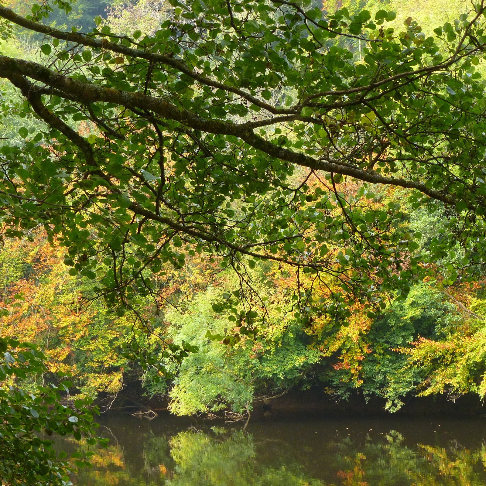
10th - 17th October 2015 - a week in the Wye Valley area near Monmouth. Long time favourite landmarks along the Wye - Symonds Yat and the valley between Tintern and Llandogo revisited. We also went walking in the Brecon Beacons / Black Mountains - the Llanthony Priory area and Pen y Fan. We were very lucky to have settled weather, though after so much brightness on the south coast in September, the cloudier weather and shortening days hit me for the first time this year. My sketches from the week will be on my Water and Art blog shortly. The autumn colours - particularly strong this year - were just beginning, adding colour to the cloudier, mistier days, especially on our first day, at Symonds Yat.
We also visited family in the area. En route to one lot on the Thursday, we stopped at Upton-on-Severn. The Map Shop there has most extensive stock of any map shop outside London (Stanfords). Strolling along the Severn afterwards, we chanced upon a Severn swimmer, accompanied by a few paddle boarders, and a barge laden with bicycles, packs and camping gear bringing up the rear. A tall man with a big dog came across the meadow to the river bank and told us all about it: the swimmer was Kev Brady, swimming the 220 mile length of the Severn source-to-sea, in aid of the Superheroes Foundation. This is the charity he co-founded in Gloucester to raise money to enable children to have treatment abroad which is not available in the UK. Previously, he has canoed solo along the Mississippi River, during the intensely cold winter hitting much of the US 2013 /14.
Link to Kev Brady's Facebook page and blogs from his journey:
https://www.facebook.com/kevbradyadventures/?fref=ts
He started the challenge on 23rd September, at the Source of the Severn, on Plynlimon in the Welsh hills. Strictly the first bit, as far as Welshpool (day 4), was brisk walking, the Severn here being just a fledgling river, not deep enough for swimming. He finished at Severn Beach a month later, in the evening darkness on 23rd October, after passing under the two Severn motorway crossings. By the end he'd raised £18,000 for his charity, smashing his targets which had been progressively revised upwards as the swim progressed. Along the way he had endured bitterly cold water and "river belly", most severely just before he got to Upton. There were concerns too, from the Severn Area Rescue Service and others as to how he'd fare in the Severn estuary, especially the most dangerous stretch, The Noose above Sharpness. I've seen for myself how strong the tidal currents are there. This is why no one had attempted to swim the entire length of the river, with the estuary until now. Thankfully, he hit the estuary during a period of neap tides which would have been moderate. Even so, he had to time his swims carefully according to the tides, so not be dragged back upstream. This was why he had to swim in the dark towards the end.
For most of the way, however, lack of current was more of a problem than too much of a good flow. According to the Environment Agency and the Centre for Ecology and Hydrology, Wallingford, the flow along the Severn, was Exceptionally Low - red dots on the River Flow maps in their monthly hydrological reports for the UK / England for October. At Bewdley, the mean monthly flow was just under a quarter of the longterm average for October in a record going back to 1921. The Wye (Redbrook) was little better at 29%. The flows subsequently recovered, at least in the short term with rainfall during the first half of November, but I wasn't surprised. Both rivers looked low when we'd seen them. At Tintern (16th October) there were the usual strong tidal currents along the Wye. We'd caught the tide on the turn while we were looking around Stella Books whose shop window looks out onto the Wye at Tintern Parva, views towards the Abbey. Further upriver at Brockweir, another ominous Careful-Where-You-Park sign. The tide was now ebbing and still running fast at the bridge here, but above it towards Llandogo on the opposite bank, it was barely noticeable. When I'd been here in 2004, when the fluvial (pluvial) flow coming downstream was much higher and healthier, the currents here had been very strong. Now it was very languid, the water looking dark, almost inky black in places, the shortening autumn days particularly noticeable in incised valleys such as this one.
 |
| Letterpressing at Red Hot Press - done with the Severn especially in mind, at the end of October |
The prevailing weather during our week away had been dry "courtesy" of a blocking anticyclone stretching all across northern Europe. The jet stream was splitting in two, with the northern track to the north of the British Isles, and a southern one bringing storms and flash flooding to the normally drier Mediterranean area. During summer autumn the jet stream has moved around. Rainfall around the UK during the summer and autumn has been geographically variable, the south apparently doing better than the Severn basin which according to the EA / rainfall data from the Met. Office, has had below average rainfall for the past twelve months. The predominant weather over the UK and NW Europe has been very very mild. Though we didn't have quite Halloween heatwave we'd had last year, highs in London were still exceeding 15C in London through to the middle of November. In France, the highs were in the low 20s celcius, worthy of September, according to Meteo France. It went on like this until the weather pattern shifted temporarily, allowing cold air to plunge down from the north, bringing an Offensive Hivernale, as Meteo France called it. Here a strong, biting north wind on Saturday 21st November. Even that, though was shortlived, with milder weather returning again during the middle of the following week.
Early, warm, usually dry springs and certainly warm, late invariably dry autumns seem to have become more and more the norm during about the past twenty years. I blame global warming, or rather global heating as I prefer to call it. Global warming sounds too cushy in view of the potentially far reaching impacts global, human induced climate change will / is already having on weather patterns / rainfall, increasing incidence of extreme weather, including flood and drought. Taken together with the projected UK population increase of nearly 10 million in the next 25 years (Office of National Statistics, 29th October) and water demand rising accordingly, the prospects for our rivers is worrying. The Severn is a source of public water supply and already has to be augmented artificially in its middle reaches from groundwater and reservoir discharges during the summer.
The low water levels on the Severn reminded me of another notably dry autumn, in 2003. Then, the Severn reached its lowest October flow at Bewdley since 1947. This year's has probably come close, too. 2003 was also notable for the European heatwave in the summer, with thousands dying in France in August. The UK got off relatively lightly but a serious hydrological deficit built from February onwards. Around the time I saw the low levels along the Severn at Bewdley (October), I had a postcard from folk holidaying in Germany - The Rhine is very low, our cruise is not possible. They told me there had been a riot on board when the holiday reps aboard broke the news. Well, it's happened again. I was shocked to read (The Guardian online app 12th November) that the Rhine has again been running very low, even lower than in 2003 and possibly 1976. Reveling in the Loire ("Severn's Big Sister", as I've noticed quite a few parallels) running so abundantly in May, I switched off to weather news from Europe over the summer, not wanting a flow-by-flow account of falling water levels. As summer in the UK was not unrelentingly hot and dry (August wet again), too, I was more surprised this year. However, on all the weather charts I've seen, the track of the north Atlantic low pressures (guided by the jet stream) has been missing much of continental Europe. Invariably, too, there have been anticyclones in the area which would prevent convectively generated rainfall (ie thunderstorms). It was much hotter there in continental Europe during the summer, and for longer (highs at or near 40C in Paris in north central France in early July). The bad news is that this kind of drought is in line with climate change predictions for northern and central Europe. Rivers like the Rhine, running off the Alps, owe much of their flow to the melting winter snow pack and glaciers. Both of which are diminishing.
Links
Environment Agency - Monthly and Weekly reports on water resources, including river flows, in
River and Sea Levels - http://apps.environment-agency.gov.uk/river-and-sea-levels/
Centre for Ecology and Hydrology Monthly Hydrological Summaries
http://nrfa.ceh.ac.uk/monthly-hydrological-summary-uk
Flood Warnings
http://apps.environment-agency.gov.uk/flood/31618.aspx
Met. Office
Met.
Office News
http://www.metoffice.gov.uk/news
Met
Office News blog, with rainfall data
Weather and Water Links - France / Europe
Guardian - 12/11/15 - Shrinking Rhine: shipping
scrapes by as river stays at lowest level for 40 years
Guardian - 27/08/15 - European ‘extreme weather
belt’ linked to worst drought since 2003
European Weather warnings (though seemingly not
drought
http://www.meteoalarm.eu/
Deutscher Wetterdienst – German Met. Office
Propluvia – map of water restrictions in France by
Department
Météo France weather forecasts
Météo France – Vigilance Métérologique (weather warnings)
France - Vigicrues (flood alerts)
http://www.vigicrues.gouv.fr/