Friday, January 13, 2017

Two Contrasting Winters

During both winters 2015/16 and 2016/17, the weather over the UK and much of continental Europe reflected the North Atlantic Jetstream being stuck in more or less the same position for weeks or months on end.  Winter 2015/16 was marked by a succession of low pressure systems passing over / close to the British Isles, bringing strong winds and truly exceptional rainfall particularly during the late autumn and early winter. Autumn 2016 and the early winter 2016/17, by contrast, was calm, often bright and generally very dry, especially December. This reflected a persistently very anticyclonic (high pressure) pattern. Notes on both winters below:

2015 / 16


In the Met. Office's first year of asking the public to name storms (low pressure systems bringing strong winds), eleven named storms affected the British Isles between early November and late March.  There was major, widespread flooding in northern and western Britain, with some exceptional outflows and river flows.

For my notes on the flood events of winter 2015/16, please see:

Rain and Flood Fury in the North , published 10th December 2015, written after the first round of major flooding in northern Britain, most notably Cumbria for the third time in little over ten years.

Difficult Confluences in the North, published 27th December 2015, written just after the Christmas 2015 floods, hitting the north yet again, most notably this time Yorkshire.

Flood Reports

1. Barker, LucyHannaford, JamieMuchan, KatieTurner, StephenParry, Simon. 2016 The winter 2015/2016 floods in the UK: a hydrological appraisal [in special issue: The exceptional winter of 2015/16 in the UK and Ireland] Weather, 71 (12). 324-333. 10.1002/wea.2822

2.
  1. UK Winter 2015/2016 floods report published | National River Flow Archive

Marsh, T.J.1, Kirby, C.2, Muchan, K.1, Barker, L.1, Henderson, E.2 and Hannaford, J.1  2016.  The winter floods of 2015/2016 in the UK - a review.   Centre for Ecology & Hydrology, Wallingford, UK.  37 pages.
Affiliations:  1Centre for Ecology & Hydrology; 2British Hydrological Society.
ISBN:  978-1-906698-61-4

Both reports give a comprehensive appraisal of the UK hydrology (river flows, run-off, groundwater, soil moisture) and the weather (rainfall) influencing it. Data from the Met. Office, Environment Agency, SEPA, Natural Resources Wales and the UK, the Centre for Ecology and Hydrology,  National Hydrological Monitoring Programme, UK National River Flow Archive. Both reports are publicly available online.

Key points:
The rainfall in northern and western Britain in November and December was truly exceptional. December 2015 was the wettest of any calendar month in the UK, in the Met.Offices's series going back to 1910. It was the second wettest winter (December - February). A new daily (24) hour rainfall record at Honister Pass, Cumbria 5/6th December, 341mm, breaking the previous record of 314mm at Nearby Seathwaite in November 2009.

This came after a sharp turn around in rainfall and river flows in November 2015. The early autumn (September and October) was relatively dry, with many rivers running below average for the time of year. Heavy rainfall through November rapidly saturated soils, meaning run off into rivers was subsequently rapid, especially in northern and western impermeable catchments.

Some impressive, record breaking river flows were recorded at gauging stations in northern and western Britain. However, records generally go back to the 1950s and 1960s, therefore representing a relatively short timescale. Flows are likely to have been higher during the historical past.

New peak flow records / notable flows:
During the Storm Desmond floods, 5-6th December, the Eden, Tyne and Lune all peaked at around 1700 cubic metres per second, the highest of all being the Lune at Caton, all the more remarkable considering it has a smaller catchment than the other two. These are the highest flows recorded on any river in England, and among the highest in Britain. They reckon the flow on the Tyne was the highest since the great flood of 1771, though that was estimated to be nearly 4000 cubic metres per second.

As well as the above, the Tay, Tweed, Dee in NE Scotland and the Ribble all attained peak flows of at least 1000 cubic metres per second. The Tay, at Ballathie in central Scotland has the highest flows of any British river, it's highest recorded peak flow was in excess of 2000 cubic metres per second in the January 1993 floods. Though it didn't get that high this time, the peak flow in early January 2016 was around 1800 cubic metres per second; and daily flows were 1000+ cubic metres per second on eight days December 2015 - January 2016.

Total outflow (run-off) from all rivers and lakes in Britain is useful for comparing flood events. A 24 hour new record was set 5th/6th December 2015, exceeding the previous one in December 2006 by a large margin. 6th, 26th, 30th December 2015 all in the top 24 hour totals. The winter also ranks high when run-off is measured over longer periods, of up to 90 days.

The Eden (right) and Caldew (left) at Carlisle
in the calm of the early autumn
(September 2016)
During the drier weather of the spring and early summer, water levels on some of the above notorious rivers fell steeply: the Eden (Sheepmount, Carlisle) registered new seasonal flow minima in May and June, on 19 days, and a consecutive 12 days.


Anthropogenic climate change is a likely aggravating factor, potentially changing rainfall patterns, melting Arctic ice possibly slowing down the jetstream, making blocked weather patterns more likely. As well as being exceptionally wet, December 2015 was also exceptionally mild, with daffodils flowering in southern England before Christmas, highs of up to 17C in southern England / the Midlands, more like April. However, this is superimposed on the high natural variability of Britain's weather. This variability was demonstrated during the contrasting winter which followed.

2016/17

Calm weather beneath and anticyclone, Chichester Harbour 27/12/16
Autumn 2016 and the early winter 2016/17, by contrast, were calm, often bright and generally very dry. Up to the first week of January 2017, there were only three named storms five as of the end of February. This reflected a persistently very anticyclonic (high pressure) pattern. For much of the winter, the low pressure systems passed well to the north of the British Isles, over Iceland, in line with a meandering jetstream looping up into the Arctic and down again through Russia and eastern Europe. To the south and west of it, an extensive tongue of high pressure encompassed the British Isles and much of continental Europe, stretching from Scotland to the Mediterranean. This is what meteorologists call an omega block. In December some of these anticyclones were intense, with central pressures upwards of 1040 millibars. Of the three low pressures which touched the British Isles, two of them, Storms Barbara and Conor around Christmas 2016,  passed to the north. Only one, Storm Angus in November, brought notable rainfall, albeit with flooding and flood warnings, to southern Britain and France as it tracked to the south, along the English Channel. The good news: other than Storm Angus, the winter was been largely flood-free, following a bright autumn with strong leaf colour persisting well into November. During December 2016 and early January 2017 there has been a good deal of dry and bright weather, making for crisp, cold frosty days, fine sunsets over our local coast and plenty of winter sunshine. Walks have been much more pleasant without the mud and waterlogged paths we usually have to contend with during the winter. The downer: falling river and groundwater levels.
The dry River Lavant, East Lavant 21/01/17

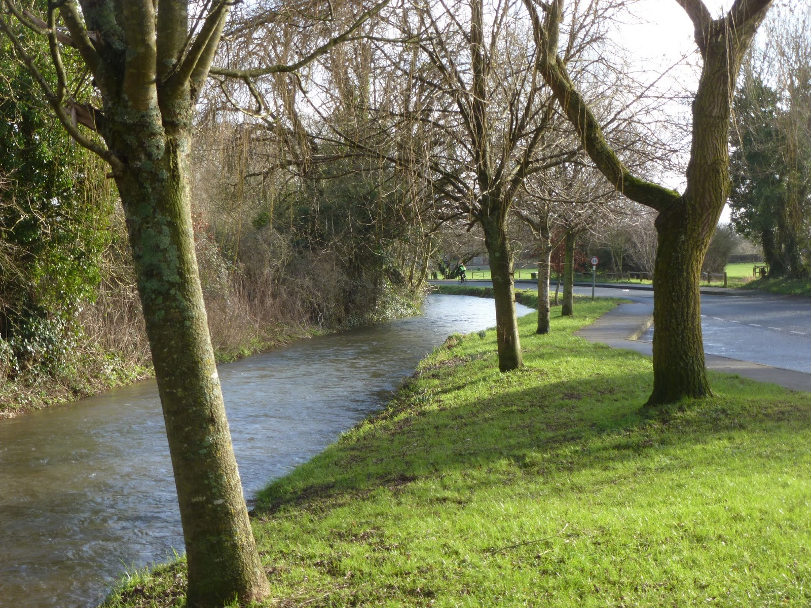
Because evaporation rates are low in the cooler weather and it is the off season for plant growth, winter rainfall is vital to recharge soils, rivers, aquifers, and public water supply; especially in densely populated areas such as southeast England.  This is something we could well pay for once evaporation resumes come the warmer spring and summer, especially if spring is early, warm and dry. Droughts followed dry winters in  1975/76, the succession in the early 1990s, 2005/06 and 2010/11. By late December, I'd already noticed the levels in some of the Wessex chalkstreams, including the Nadder and the Avon around Salisbury, falling. In their monthly hydrological summary for November and December, the Centre for Ecology and Hydrology (CEH) said that some areas of the UK needed to be "vigilant" in the event of a dry winter, due to low reservoir stocks, especially in SE England where one reservoir was under half full (Ardingly, East Sussex). By the end of December, both CEH (UK) and the Environment Agency (England) said that most rivers across the UK were running below their respective long term gauged averages, some of them exceptionally so (red symbols on River Flow maps): among them the Exe, Wye, Welsh Dee, the Dorset Stour; and the rivers of East Sussex and Kent. One (the Eastern Rother at Udiam) was down to just 6% of its long term average mean monthly flow for December. Even the chalk streams in Wessex, usually relatively slow to rise and fall, were feeling it: with the Salisbury Avon under 40% LTA and the Itchen 72%. The groundwater in many index wells in the southern Chalk had not recharged and was still falling in some cases, eg Chilgrove. 


Apart from a brief period following the passage of Storm Angus, water levels across the Channel in much of France have been well down since the late summer Eaufrance, http://www.eaufrance.fr/ . There, the anticyclonic autumn and early winter came after a hot dry late summer, with heatwaves in some areas, such as Paris. It was much the same here in autumn-early winter 2015/16; but then a shift in weather patterns in January 2016 enabled recharging rainfall. Notably low levels in Loire and tributary valleys western France / Brittany.

In the second week of January 2017, the synoptic pattern shifted temporarily, though not before it plunged bitterly cold Arctic air well down into southeastern Europe, with snow in Greece and Turkey. Bitter cold in normally relatively warm areas not used to it. In comparison, the wintry weather affecting the UK later that second week was trivial. Even so, it brought not only the customary transport disruption but also tidal  surges along the North Sea coast of Britain. Early on the morning of Friday the 13th, the Environment Agency had 17 Severe Flood Warnings (potential danger to life) along the Essex and East Anglia coasts, plus a rising number - 90+ by midday - of Flood Warnings and 80+ flood alerts during the middle of the morning.

http://www.bbc.co.uk/news/uk-38605842
http://www.bbc.co.uk/news/uk-38594739

Snow / tidal surges - Europe
http://www.bbc.co.uk/news/world-europe-38607862

In the third week of January, the omega block pattern, with high pressure over Britain and continental Europe became established once again, the pressure at home in south Hampshire rising to 1039 millibars on Wednesday 18th January. It then fell slowly, before sticking around 1028 millibars. Once again, a good deal of bright, crisp frosty weather. When we went out walking at the weekend, it was a pleasant change not to have to wade through lots of mud, much of being frozen, at least during the morning. As I'd expected, however, there was no water in the River Lavant when I walked along Sheepwash Lane, East Lavant and up to the Trundle. The first no-show of the winterbourne for five years.

The final full week of January began with widespread freezing fog, icy pavements being a particular problem in the immediate area where I live. There, it is usually the motorway noise I tend to hear when the air is still. This time (overnight 23rd / 24th January), it was distant foghorns.  In the very still air, air pollution levels rose as there was little or no wind to disperse the fumes (NOx, particulates) from traffic and wood burning. What wind there was (easterly - southeasterly) brought more pollution from the continent. Though pollution levels on the Hampshire coast were lower than they were in London, some stretches of road felt smelt very fumy. I got to the mouth of the River Hamble on the Warsash shore on Tuesday 24th January late morning. By then the sun was coming through and the mist was clearing, though Fawley refinery was still largely shrouded; the top third of the power station chimney poked out of the mist. To the south, a hazy silhouette of Calshot Castle, but the IOW was completely shrouded; still the occasional sounds of foghorns out in the Solent. What was really noticeable, though was the low note industrial hum in the air. Presumably from the refinery across the water; perhaps noise from the container port at Southampton, too. Normally, we don't tend to hear these. Aircraft noise more noticeable than usual, too.

February and March were more mixed, allowing for a pick up in river flows  at least temporarily; and to some extent groundwater reserves. Yet, the rainfall was episodic, with dry anticyclonic spells in between. It was also very mild, meaning that spring didn't wait.

In February, most of the rain fell during the first and last weeks of the month. During the final week (23rd), the fourth named storm, Doris. This affected mostly the Midlands and north, with high winds and snow on hills. Euan followed a few days later (26th). Most of the action its action was over Ireland, the Irish weather service having named the storm. During the middle of the month, though, high pressure re-established as a very intense high (central pressure over northern Scandinavia 1051 millibars at one point) drifted south over continental Europe. Though western and northern parts of Britain received above average rainfall during March, rainfall was below average in SE England (Met. Office 1981-2010 average, with records from 1910). 

Links
Water and weather information:

UK Meteorological Office
http://www.metoffice.gov.uk/public/weather

Environment Agency (flood warnings, England)
https://flood-warning-information.service.gov.uk/

Environment Agency (rivers and sea levels, England)
https://flood-warning-information.service.gov.uk/river-and-sea-levels

Environment Agency - monthly and weekly water resources reports (England)
https://www.gov.uk/government/collections/water-situation-reports-for-england

SEPA (Scottish Environmental Protection Agency)
http://apps.sepa.org.uk/waterlevels/

Natural Resources Wales
http://naturalresources.wales/our-evidence-and-reports/maps/river-levels-online/?lang=en

Centre for Ecology and Hydrology -monthly hydrological summaries for the UK, UK National River Flow Archive and National Hydrological Monitoring Programme:
     Monthly hydrological summaries:
      http://nrfa.ceh.ac.uk/monthly-hydrological-summary-uk
     Gauged river flow data - http://nrfa.ceh.ac.uk/data/search

Eaufrance - http://www.eaufrance.fr/ (monthlyhydrological summaries)
Vigicrues (flood warnings and gauged river flows)
http://www.vigicrues.gouv.fr/

Meteofrance (the French weather service) say that December 2016 was marked by record sunshine and exceptionally low rainfall, the rainfall deficit surpassing that of December 2015.
http://www.meteofrance.fr/actualites/44311414-decembre-2016-tres-sec-et-ensoleille

Media Reports:
BBC News - http://www.bbc.co.uk/news

The Guardian - https://www.theguardian.com/uk

Potential influence of melting Arctic ice on weather patterns (The Guardian 19th December)
https://www.theguardian.com/environment/2016/dec/19/arctic-ice-melt-already-affecting-weather-patterns-where-you-live-right-now?

Cold weather in Europe (January 2017)
European cold wave circa 8th January


UK Wintery weather/ tidal surge  12/01/17

Freezing fog / air pollution: 

BBC News 23rd January (London smog alert)

Guardian 23rd - 24th January

Thursday, January 21, 2016

Giving it Welly in the Lavant Area

Saturday 16th January

Levin Down from north of St. Roche's Hill
Bright after a hard frost overnight.
Wearing new wellies, I returned to the Lavant area for a longer walk, taking in the upper Lavant valley to the north of The Trundle. 

As I'd done on Tuesday, l walked out to East Lavant along the Centurion Way, now according to 0S Explorer map, aka the Lipchis Way. l then walked up Chalkpit Lane towards The Trundle (aka St. Roche’s Hill), taking the path contouring around the south side of the hill towards Goodwood. Following the road eastwards alongside the racecourse, l took The Monarch's Way path off to the left, past the big piles of logs and down the hill towards East Dean. I meant to go to Charlton, but forgot to take the other path down the hill. thence the walk turning out rather longer than I'd originally planned. Lunch on a chilly bench on the green at East Dean. This faced the pond, officially the source of the Lavant, though it actually rises a bit east of there, a narrow stream running alongside Chapel Row and under the road (Main Road) behind me. A quick sketch, though not the weather for hanging around.

East Dean pond
Then walked to Charlton along the road, the widening Lavant stream running alongside on my right. Fair bit of clutter and car flappery when I got to Charlton, seemingly for the the pub on the far side of the road, which looked suspiciously like a gastro-pub. At the crossroads past the hotel, turned left and did a quick pencil sketch looking along the Lavant, running through the field towards Singleton. Levin Down across the road on my right. Then followed the path through the field to Singleton, a couple of big puddles in the centre of the field and very muddy at the far end where cattle had churned it up. From the Singleton church, took the path up hill towards The Trundle, coming out onto Knight’s Hill lane which met the Goodwood road by the car park. Awkward crossing of the Goodwood road to the path up the hill to fort. Limited visibility with the bends which some people can take rather fast. Though I’d been going quite well until now, slowed going up the hill, not feeling 100% (see below).

Towards Levin Down and Singleton from Charlton
Left The Trundle via the path westwards to Haye’s Down. In the field below Haye’s Down, the Lavant was looking pleasingly abundant, catching the late afternoon light. By now (about 3.30pm by the time I’d done my quick sketch), I was conscious of having quite a few more miles to go (about 5) with limited daylight (lighter than at the beginning of the month, though still dark by 5.00pm). After quick looks at the now relatively broad Lavant running through the fields from East Dean towards Binderton House (across A286) and Ox Barn. Kept the way back into the city simple, following the Centurion Way (even where not paved, mainly mud-free) to Mid Lavant. A pleasantly copious flow again where the Centurion Way crossed the stream. It now looked more like the sort of size river that might be expected to run along this valley; the Lavant being a misfit stream, too small for its valley. Perhaps in the distant past (probably Pleistocene or early Holocene), when the chalk escarpment of the South Downs would have been further north than it is now, a larger river drained this valley from the north, with the upper Lavant between East Dean being a tributary. As erosion cut the escarpment back southwards, exposing sandy layers in the Lower Greensand, it’s likely the Western Rother cut back and captured the upper reaches of the Lavant.

The view over the Lavant from Haye's Down

At the foot of Haye's Down

The abundant Lavant above Mid Lavant
Back in Chichester 5pm. Though tempting, time was getting on, so I didn’t linger for a coffee.

Actually, walking boots would have been more suitable, and more comfortable, given the length of the walk (about 15 miles) and the frost / ice lingering in places. This frost took the edge off the mud and the South Downs are easier wrt to mud than the clay soils closer to home, or The Hangers, though there were still a few muddy bits around Singleton. Mostly walked along tracks. 


Wednesday, January 13, 2016

The Lavant Runs Again...


12th January 2016 - Wind still westerly, but feeling very chilly in it, especially when cloudy / dark. Bright morning before clouding over around midday.

The Lavant re-emerges - Chichester south


Went to Chichester specially to see the Lavant, now flowing well after a late reappearance this winter. It was racing out of the culvert under South Street as if glad to see daylight again after its banishment beneath the city streets, the channel here still relatively confined. Plenty of water in all the diverging, constrained channels on the south side of the A259, too. It wasn't as high as it had been this time in 2013 or 2014. Water in the channel south of the cathedral and city wall probably about a foot deep.

I don't know exactly it returned, but a month ago it was still dry. What a change in a relatively short space of time. Last week the EA River & Sea Level’s page (Southeast – Solent and  South Downs, Graylingwell) indicated it was more than high enough to flood. The turn around has happened not just onthe Lavant, but also on rivers throughout southern and lowland England.

When I got home, I ordered some new wellies online (Blacks): a drought of wellies in the shops after winter sales and the general swampy-ness everywhere right now. After a succession of wet winters and our general area being especially bad for mud, l tend to wear through wellies fairly quickly (three pairs in as many years). Also walk longer distances in them the typical welly wearer might. My walk out and back to East Lavant confirmed they were no longer up to the job. Though no visible splits or holes in the soles or join with the sole, water still getting in somewhere when I tried walking through puddles, making my socks damp. Soles don't tend to be very thick either, meaning uncomfortable when walking along rougher, more flinty paths. /This was even though l avoided the soggiest / boggiest bits, by walking in /out of the city mainly along pavements to Brandy Hole Copse and then along the Centurion Way to Lavant.

A Centurion along the Centurion Way

At East Lavant, alongside Sheepwash Lane, again, not as high as it was 2 years ago, when it was brimming over. Now well within bank but fairly high beneath some of the brick footbridges leading to / from the houses along the lane and the bridleway north towards The Trundle.

East Lavant


Did a few sketches along the way;  because of the cold, I had to keep them fairly quick: hence pencil only south of the city wall, looking westwards along the path here to a red brick bridge. Along the Centurion Way, in the open area around the “amphitheatre” one of the “Centurions”, viewed looking north along the path to where it went under a road bridge. A pole in the centurion’s left hand. He’d also acquired a scarf (handkerchief), removed by the time I came back this way. Then, thirdly, looking along the Lavant from the road bridge at the east end of Sheepwash Lane, for comparison with the one I did here a month ago when the channel was dry.


East Lavant - 12th December 2015

East Lavant - 12th January 2016
After packed lunch on a bench on the edge of the green, as sheltered as possible here, tried walking along the bridleway across Sheepwash Lane alongside Staple House Farm. Once again, only got so far, because wellies weren’t up to the petite crue (puddle) with no way round either side.

The big downer / feel awful factor hanging over the Lavant - the stream and the village is the prospect of having a thundering expressway rammed through it (revving up the A27 /Chichester northern bypass. Blogged about this last month. A downer certainly for someone like me who has become very attached to this place, as intermittent as the Lavant may be. There are no firm proposals or decisions yet on possible options, however a northern bypass is one of them. As at Arundel, there are people who seemingly hell bent on going for the most environmentally destructive option. It would be far more sensible to improve the pre-existing dual carriageway to the south of the city instead of intrude into the South Downs National Park and wreck the relative peace and quiet to the north of the city. East Lavant would, at the very least be have considerable traffic noise and poorer air quality inflicted upon it, even if  they road lay out in the village was left much as it is now. It is great, too, to be able to walk out from the centre of Chichester to the South Downs without having to negotiate a potentially dangerous road crossing. Anyone who has walked the ridge of the Downs via the South Downs Way or Monarch’s Way will know that there is a tricky road crossing  about every ten miles, if that.  As is the case when attempting to walk out to Chichester Harbour from the city centre.

These are the first few key facts, pasted from the Chichester Deserves Better homepage:

  • Highways England are considering 6 options to improve congestion on the A27 around Chichester.
  • 4 options are improvements or upgrades to the existing route.
  • 2 options are a northern bypass that will pass through Fishbourne, West Broyle, Lavant, Goodwood, Strettingon and Boxgrove.
  • It has been confirmed that the bypass will be an Expressway meaning it will be a dual carriageway with national speed limits.
  • The route would run along the boundary of the South Downs National Park causing irreversible damage.

Sunday, December 27, 2015

Difficult Confluences in the North

Ouse in the News again as York floods after Boxing Day deluge

Here’s to a peaceful, storm-free Christmas, I said to the River Avon before we left Pershore to head home the Monday before Christmas. I had in mind here the floods in Cumbria earlier in December, the flooding in SE England on Christmas Eve 2013, along with major flooding along the Tewkesbury / Warwickshire Avon in April 1998 and July 2007. The level of the Avon now looked fairly normal. Notwithstanding all the waterlogged ground and mud everywhere, we got off lightly in the south. It rained as we tucked into our Christmas dinner. Boxing Day was dry, though very dull and windy. Though we were blessed with a peaceful Christmas, this was not the case everywhere around Britain.

As Christmas falls during what are usually the wettest and stormiest months in Britain and NW Europe  - the north Atlantic depressions at their deepest – there’s every chance that there will be flooding somewhere in these areas over the Christmas-New Year period. In 1982 it was France (the depressions must have been further south that year; late December 1999 was very stormy in France, too. Two years ago it was southeast England. This time – as if the flooding from Storm Desmond earlier in the month wasn’t enough – northern Britain was hit by Storm Eva which rolled in during Christmas Day and deluged the Yorkshire and Manchester area on Boxing Day. There was also renewed flooding in Cumbria (including Ullswater, Appleby) just before Christmas (21st / 22nd December). Then, at the year’s end, it was Scotland’s turn, with Storm Frank on 30th December.

Among the worst affected and / or attention grabbing areas in the aftermath of Storm Eva were Manchester, Leeds and York. In the Manchester area, the River Irwell, a tributary of the Mersey, took out the wall of a pub. In Leeds, the River Aire rose to record levels: upwards of 5m above normal, a good metre up on the previous high. Vaguely remember hearing during the November 2000 flood that the water here was running in excess of 1000 cubic metres per second. This would have been even more, then. In the aftermath of the flooding, the UK government came under renewed criticism for cutting spending on flood defences. Leeds had been in line for a major flood defence programme, only for it to be cancelled. In York, pumps failed on the Foss flood barrier on Boxing Day (Saturday afternoon) which meant they had to keep the barrier open. This led more widespread flooding around the city than usual: not only was the Ouse running very high from all the water coming down from the Pennines – there was also flooding along the smaller River Foss, all the more as the floodwater from the Ouse backed up along it. The Ouse peaked at just under 5.2m in York City centre (EA Viking Recorder, 28th December AM, 5.17m, 17’ 1’’). This was lower than the peak of the 2000 flood (5.4m / 17’8’’, 04/11/2000), but now ranks as the second highest flood recorded in the city. As there has been a large flood here roughly every ten years since the early 1980s, I thought they’d had their fill for the 2010s in September 2012 (5.07m, 16’ 8’’, 26/09/2012). The existing flood defences – raised floodbanks, directing some of the excess flow upstream of the city centre into Clifton Ings, the Foss barrier – were completed in 1987, following the notably high flood in 1982. That was in early January – 5.05m / 16’7’’, 05/01/1982. Particularly as I was immersing myself in all things rivers at the time, I remember the news reports quite well. True my mood my perceptions were coloured by teenage moods and a low point in family life, but even in the cushy south it seemed gloomy right through from December to March. This flood came after a rapid thaw in heavy snowfall, the last time I remember snow melt having any significant influence on flooding in England. TV news reports showed footage of York underwater. Downstream Cawood and Selby were badly affected; as they were this time round. The River Wharfe joins the Ouse at Cawood. That was on severe flood warning 28th – 29th December as it took out a bridge at Tadcaster.

Storm Frank rolled in on 30th December. The low pressure involved here, took a late turn north, therefore Scotland bore the brunt of the weather this time. Notably badly hit areas were Deeside. Dumfries and Peebles. The Tweed at was among the rivers SEPA had on severe flood warning. Video footage of the river running high and fast very close to the top of an iron footbridge.


Environment Agency – Flood defences need a complete rethink – Guardian 28/12/15

Failed flood defences cast doubt on UK readiness for new weather era:
http://www.theguardian.com/environment/2015/dec/27/floods-army-called-continue-devastate-northern-england?CMP=Share_AndroidApp_Drive

As said previously, the Westminster government has got its public spending priorities wrong when it comes to infrastructure, with airport expansion and damaging new road schemes seemingly deemed more important than protecting people – including major centres of population such as Leeds – from flooding and what some commentators are calling a new era of weather amid rapid human induced climate change. Seemingly for decades parts of the north of England has suffered economically while the economy in London and the south has overheated. For one thing, new runways for Heathrow and / or Gatwick, but alternatives in the north are off the table. When it comes to flood defences, there have been claims during the aftermath of the recent deluges that the south has benefited at the expense of the north, too. Expensive flood defence schemes approved for the Thames valley and Littlehampton, yet not Leeds. The real issue is that the whole of the UK is exposed to flooding. In winter 2013 / 14, southern and central England had a triple whammy of fluvial, groundwater and tidal flooding, with the Somerset Levels and the Thames valley being among the areas worst hit. Out and about along the Hampshire coast at Langstone after Christmas (28th December), I was reminded yet again of just how low lying and exposed this stretch of coast is, even to a normal spring tide. There were flood barriers and bags on the doors of buildings along the shore, such as the Royal Oak. Seaweed debris encroached onto the shoreward end of Langstone high street from the peak spring tide over the weekend. An RNLI lifeboat painted on the flood barrier across the door of no.15. Sandbags. All beneath a tired looking Christmas wreath.

Since at least the floods of 2000, the general pattern has been as follows: a deluge of media coverage from the affected areas; miserable footage of flooded properties / people being rescued from them; news crues standing in big puddles in wellies and waders; the PM putting on the wellies for the Sorry about your flood – yes, we’ll invest in flood defences walk. The a prolonged period of calm, dry weather; when that all gets forgotten, until the next round of flooding. Meanwhile everyone affected by the flood left to clear up all the mess and wait for their homes to dry out and be habitable again, long after the  news crues have moved on to the next big story.

When the weather calms down after this lot, how about a sensible debate, followed by real action on flood defences - the best sort of defence at a given place; and how to best prepare the UK for the effects of climate change and the already seemingly increasing incidence of so-called extreme weather. One big thing about the floods from Storms Eva and Desmond was that they hit areas which had had flood defences built following major flooding during the past 10-15 years. Most notably Cockermouth, Keswick and Carlisle. Yet they proved inadequate because of the sheer quantity of rainfall. I’d thought until now, York was one of the best protected cities in the UK outside London (do I remember rightly that the estimated cost was £22 million in 1982 money?). Even with more flood defences with money  no object, the increasing incidence of extreme weather / intense bursts of rain, there’s potential for an arms race involving higher and higher flood walls vs bigger and bigger floods. Are there any lessons to be learned from elsewhere in Europe, most notably Holland? The population density is similar to that of the UK, with large areas of urbanisation and intensive agriculture. The land is low lying, and susceptible to flooding from the North Sea, together fluvial flooding from the delta of the Rhine and Meuse.

We need a Dutch-style Delta plan to stem the tide of floods, Henk van Klaveren, The Guardian27/12/15

Guardian Editorial 27/12/15

Guardian Letters 27/12/15

Reports


Storm Eva

Guardian / Observer


Storm Frank


Christmas Weather Goes Crackers

Missing – One Winter - as Christmas approached, temperatures in southern and central England more like March or April – a balmy / barmy, blowy Christmas - melting ice rinks – daffodils flowering for the winter solstice / Christmas (my photo taken at East Meon, 23rd December). Overall very disconcerting and disorientating. Seemingly Christmas has gone totally crackers this year.

While in the Worcestershire area, the weekend before Christmas (19-20 Dec), bats and buds. On the Sunday,  we took a very muddy walk on Bredon Hill, then called into a café in Pershore. There we read the paper (The Observer, 22nd December, which had a double spread about all this sort of stuff –  All Calm on the Cam: highs of 17oC in eastern England as crazy December weather continues (Cambridge) plus feature on p 12-13 about the causes: human induced climate change (global heating) coupled with the strongest El-Niño in the eastern Pacific (off Peru) since at least 1997. Where were, the highs were around 15oC. A complete contrast to this time during 2010 when it was particularly cold around Pershore, with night time lows dropping to almost-19oC (BBC News, 21/12/2010 - http://www.bbc.co.uk/news/uk-12034317?print=true).

White Christmas off and UK ice rinks melt in mild December weather - The Guardian, 23/12/15
http://www.theguardian.com/uk-news/2015/dec/23/white-christmas-is-off-as-ice-rinks-melt-in-mildest-uk-december-since-1960

Butterflies in church bats along-the-river - Guardian letters - online 24th December (paper copy, 26th December) . One from Arundel Castle's head gardener who said some of their flowers seem to think it’s spring already; bugs and pests not being killed off; and the risk the fruit harvest if early fruit blossom was to be followed by frost. The bats were along the River Aire, which subsequently reached a record level in Leeds amid the Boxing Day deluge (next entry).
http://www.theguardian.com/uk-news/2015/dec/24/butterflies-in-church-bats-along-the-river


In January, the Met. Office confirmed that, December was the warmest in records for the UK going back to 1910, along with the wettest recorded calendar month. After recent wet episodes such as winter 2013 / 14, that took some doing, going to show just how crazy the rainfall in the north was. 
http://www.metoffice.gov.uk/news/releases/archive/2016/december-records
The mean monthly temperature average for UK overall showed the highest anomaly recorded for any calendar month (just over 4oC), with the mean temperature for England over 9oC. Thanks to all the sog in northern England and Scotland throughout December, 2015 now ranks in the top ten wettest years in the UK record.

There was a distinctive all-or-nothing north-side in rainfall either side of the English Channel as the blocked weather pattern  over Europe during November continued. The jet stream tended to track just NW of the British Isles bringing all the rain to northern and western Britain; and persistent high pressure over continental Europe making for warm, southerly / southwesterly airflows. This meant with very little or no snow over the Alps and Pyrenees, none over the Massif Central. Aside from spoiling the fun for skiers, this will have real hydrological implications on major European rivers such as the Rhine if it continues like this all through the winter. 

Yet again northern parts of Britain was battered by storms and had to endure flooding during the week after Christmas (Difficult Confluences in the North - Storms Eva and Frank). 

News from the Dry Zone (France), meanwhile, of the Loire stuck at its summer level (French media site, France 3, 30th December):
La Loire à son niveau estival : faut-il s'en inquiéter ?
In answer to this question, worrying though not at all surprising given the synoptic pattern: the Loire receives most of its flow from  rain associated with Atlantic weather fronts its flow peaks during the winter. It goes to show how full-on / full-off the rainfall patterns over northern Europe have become; in rainfall amount and its geographical distribution. I hope things improve in January. During the hot spring of 2011 it ran virtually dry.

According to Eaufrance's hydrological summary for December. Averaged nationally, the total monthly precipitation 70% on what they’d usually expect (1981-2010 average) and the driest December in a record going back to 1959. River flows well below average for the time of year, especially the Loire southwards. 
 Météo France – in their monthly summary of the weather across France in December - http://www.meteofrance.fr/actualites/32167565-un-mois-de-decembre-printanier-pour-finir-l-annee-2015 - they said that December was spring like, with temperatures exceeding those in March. Nationally, the mean temperature anomaly was similar to that of the UK. Whereas the UK experienced lots of dull and wet weather, they had it very sunny, and also very dry, with rainfall nationally 15% below average (records back to 1900, again 1981-2010 average). Overall, 2015 was the third warmest year in France, after 2014 and 2011 and among the ten driest during the past fifty years, with rainfall 10% below average nationally. It was the second warmest year in Europe.
The worrying thing about the dry weather across continental Europe (as noted recently) is it is consistent with climate change predictions. Also very worrying is the marked warming in the Arctic. According to climate scientists, this maybe why the jet stream is getting stuck in one position on a seemingly increasingly regular basis, invariably taking a loopy, meandering course as it has been lately. See also:
http://www.meteofrance.fr/actualites/32536533-2015-une-annee-chaude-bien-ensoleillee-et-peu-arrosee


The end of the year, all the warmer with the added influence of the strong El Niño building in the eastern Pacific since the summer.  This involves warming of the sea surface in the Pacific off the coast of South America. It exerts its biggest influence, then around the Pacific – this year forest fires in Papua New Guinea and Indonesia, drought in eastern Africa, drought and flood in Australia, wet in California (but until now they’ve had a protracted drought), warm in Alaska and western Canada. Whereas the Atlantic had a relatively quiet hurricane season, there were more typhoons than usual in the northern Pacific, including one which hit the east coast of Mexico. Though Europe is further away from the action, El Niño’s effects feed into global weather patterns as the ocean-atmosphere is a planet-wide, interdependent system. It has also been exceptionally warm in New York / US East coast. 

El Niño brings Christmas chaos
http://www.theguardian.com/world/2015/dec/28/from-paraguay-to-the-us-australia-to-spain-el-nino-brings-christmas-chaos?CMP=Share_AndroidApp_Drive

El Niño means the (Christ) child as it usually peaks around Christmas. It happens roughly every seven years, buts its irregular.

The strongest events during the past forty years were 1976 /77 – Recall a National Geographic Cover / Feature – The Year the Weather Went Wild – The Golden State Dries Up (drought in California) – Snow in Miami, Slush in Alaska – bears coming out of hibernation in Alaska early as icicles formed on Florida oranges.

1982 / 83 – National Geographic - El Niño’s Ill Wind. News reports of major flooding along the Mississippi River in the autumn; Christmas crues in France – the track of the jet stream and low pressures must have been further south that year – then in early 1983 drought, forest fires and flood in Australia – flash floods and mudslides in California.

1997 / 98 – Forest fires in Indonesia (2015’s even worse yet largely ignored by the UK / European media); 1998 the then warmest year globally on record. Wet again California. Notably mild but wet at times in the UK. Spring early in Alaska, heatwave in western Canada summer 1998.

Globally, temperatures at the Earth’s surface are rising year on year, with 2015 topping 2014 as the warmest year on record globally and 2016 predicted to be even hotter. El Niño is contributing to the current glut of warm years, but thanks to global warming, it’s been almost year-on-year since the beginning of this century and most of the warmest years have been during the past thirty years.

Guardian 27/12/15 - UK floods and extreme global weather linked to El Niño and climate change
.


Thursday, December 10, 2015

Rain, Flood and Fury in the North

December 2015

The flood misery in northern England and parts of Scotland in the wake of so-called Storm Desmond, is another sign, surely of extreme weather becoming the new norm amid a rapidly changing climate.

Early on the morning of Saturday, 5th December, I knew rivers and things were up when looked on the Environment Agency's Flood Warnings Summary and River & Sea Levels  (England & Wales) pages, before heading off on the train to London. The flood warning count was up to 45. The Severn had been rising slowly during the previous week, following heavy rain on the Welsh Hills the previous weekend. It was due to peak at Tewkesbury later on Saturday. This was a regular winter flood of the sort they expect along the Severn during most winters. Most of the new warnings were in northern England, where the real trouble was ensuing. Scotland as well (covered separately by SEPA). As we've seen for ourselves, albeit to a lesser extent during more regular, less intense spells of rain, northern rivers tend to rise very quickly, before dropping again just as quickly. The EA's hydrograph for the Tyne at Corbridge showed the water level shooting up several metres overnight and  was well over flood point. 

On the train back down south, the Arun was in its usual glum mid-winter mood; the colour of weak tea and somewhat windswept. This was around half-eight, but still barely daylight because it was so dull and cloudy. Yellow bands of weak low sunshine in a gap in the cloud south towards the coast. As I strolled round London and sketched along the Thames during the middle of the day (relatively calm with a neap tide), little did I know that the River Eden was running amok through Appleby-in-Westmorland. By the time I was on the train home, back along the Arun valley and south coast in the darkness, the EA had 91 flood warnings out, along with over 40 severe flood warnings. Two of them were along the Tyne at Corbridge, which was up at 5.6m (normal range here 0.13 - 3.30m). All the other SFWs were in Cumbria, including the Eden and Caldew in Carlisle; the Cocker and the Derwent at Cockermouth; the Derwent and the Greta around Keswick; the Kent, including Kendal; the Eamont out of Ullswater...By Sunday morning, 6th December,  SEPA also had a SFW out on the River Teviot through Hawick on the Scottish border. The Tay, Tweed and Clyde were also reported to be running high - I'm being more vague here as SEPA don't seem to have as much publicly available / accessible information on their flood warning pages as the EA have south of the border.  

This was the third major flood to hit Cumbria in little over ten years. Yes, the Lake District is the wettest area in England, yet it shouldn't have been this wet. Daily rainfall totals in the hundreds of millimetres are more akin to tropical cyclones than low pressures systems coming over the British Isles from the north Atlantic.

The floods in January 2005 and November 2009 - were put down at the time as likely to occur only once a century.  The 2005 flood in Carlisle was well above that of the previous high (March 1968). This one broke the record again.  The Met. Office said that 341mm fell on the Honister Pass, near Keswick, during the 24 hours from 6.30pm Friday 4th December. The previous record for England, set during the 2009 floods had been set in November 2009: at Seathwaite, not far away in Borrowdale - 316mm in 24 hours (20/11/2009). At Thirlemere, the 48h record was slashed (405mm). Following the earlier floods, flood defences were built in all these areas, thought at the time to be robust enough to withstand a soggy repeat. Well they bought people time, to evacuate their homes/ businesses to move things out of harm's way. In the end, though, the sheer amount of rain involved proved too much: the rivers overtopped them. An outcry about government cuts to flood defence spending subsequently ensued. Thousands of homes and businesses across Cumbria were flooded.

Wherever it happens flooding's always messy and miserable. As I probably said during the last round of floods in December (SE England Christmas 2013), to have it happen during the run up to Christmas, at what should be a happy, celebratory time, is all the crueler. And it's not just the immediate term: long after the news crues have gone, people are stuck in temporary accommodation, eg caravans while they wait for their homes to dry out / become habitable again. Invariably (eg Gloucestershire 2007) it can be well over a year. Invariably, too, longterm emotional stress with the memory of it all and subsequent nervousness everytime it rains.

The rainfall patterns during the past few decades seem to becoming more and more binary. They are either full-off as in much of continental Europe for much of this year. Apparently, the Rhine's been down to another record low this autumn. If not, they are full-on, with more intense rainfall like the kind above.  As the Guardian said online, major flooding somewhere in Britain is becoming almost an annual event. This increased rainfall intensity and all-or-nothing binary pattern could likely be even more common thanks to human-induced climate change. A warmer atmosphere holds more water vapour. We seem to be seeing more and more episodes of blocking weather in which the north Atlantic jetstream, hence the track of the rain-bearing low pressure systems, is stuck in one position for weeks or months on end. This December, there has been high pressure bringing predominantly dry weather across continental Europe. The  track of the low pressure systems and their associated rain-bearing fronts has been across northern Britain. One editorial (The I - Independent lite, 8th December) said what we are seeing now is the future we envisaged twenty or thirty years ago.

The culprit this time was Storm Desmond, Typhoons and hurricanes (tropical storms at lower latitudes) have long had names. The more moderate north Atlantic low pressure systems had been going with the names given to them by an meteorological centre in Berlin (the very deep low which brought gales and flooding across southern England just before Christmas 2013  was called Cyclone Dirk across the Channel). The Met. Office's move to get the public to name this winter's lows had seemed a bit pointless, maybe even sensationalist, when we used to just call them plainly and simply low pressures / deep depressions. Given what ensued with Desmond, however, calling it a storm and giving it a name seemed very appropriate -  a list of names for this winter's low pressures
systems.  Previously this winter, we've had Barney, Abigail, Clouda, always alternating between male and female names.

The prevailing weather pattern during November and early December feature a blocking high over continental Europe, with the lows passing to the NW of the British Isles with fronts sprawling across mainly the northern half of Britain. Meteo France btw, said November was warm and sunny, across France, with highs in the 20s-celcius during the first week, including northern France. Rainfall was below the longterm average in most areas.

http://www.meteofrance.fr/actualites/31285346-un-mois-de-novembre-tres-chaud-et-ensoleille

On both sides of the  Channel the mild weather during the autumn has continued into December. With highs in southern England of 12C upwards, it doesn't seem like a proper winter. Dark season would be more accurate. The nearer we've got to the end of the year, the more disorientating the mild weather has felt. Whereas, the north has had way too much rain, there's every danger of the European drought carrying on through next year, especially if the higher temperatures lead to less of a snowpack over the mountains to recharge rivers such as the Rhine.

A selection of News reports / Youtube Footage

By the middle of the following week, numerous You Tube Storm Desmond videos had appeared clearly showing the extent and fury of the flooding:

Carlisle underwater - aerial views. City mostly unrecognisable, even with the helpful captions pointing out places such as Debenhams, The SANDS Centre and the McVities biscuit factory. I heard someone speculate (Call You and Yours, BBC Radio 4, 8th December) that the future of the latter as a longtime local employer may be threatened by repeated flooding. 

Confluence of Eden and Caldew, where on a much more peaceful morning in August 2007, someone said they see otters there. Now, the junction and course of both rivers was impossible to trace beneath several metres of muddy water. River Eden right up to the top of the arches of Scotland Bridge, the main road bridge.  During earlier quiet times, a fine summer's evening enroute to my very first trip to Scotland, age 15, my father sketched.

Ullswater - Pooley Bridge taken out by force of water flowing out of the lake. The YHA (Patterdale) up the valley was sometimes as a stopover enroute to Scotland with my Munros Man.

High Force - where the River Tees meets the harder dolerite rock of the Whin Sill. Among the places visited during a week's residential school course on The Geology of the British Isles with the Open University during the early 2000s. Now more than living up to its name and most impressive.

Unusually, water flowing over the cliff of Malham Cove. They say it did just after the last Ice Age when the ground was frozen, but now the waters of Malham Beck sink into the ground just after they flow out of Malham Tarn, before re-emerging at the foot of the Cove (Guardian centrefold, c7th December). 

The Fury of the Flood

Update 21st January 2016:

CEH National River Flow Archive / Monthly Hydrological Summaries for the UK
Environment Agency Water Situation Reports for England

In their monthly hydrological summary for the UK, the Centre for Hydrology and Ecology (CEH) described December 2015 as "an extraordinary month both in meteorological and hydrological terms". These summaries include rainfall data from the Met. Office, soil moisture, groundwater, reservoirs stocks as well as river flows. The emphasis this time was indeed on flooding and what were exceptionally high flows in a number of catchments in northern Britain. An estimated 16,000 homes were flooded during the month across England alone (see later entries in 2015 about the floods in Yorkshire following "Storm Eva"), around 6000 of these in Cumbria. Not only did Cumbria suffer during "Storm Desmond", but also during the heavy rainfall events around Christmas, too. UK-wide, it was the wettest calendar month, thanks the exceptional rainfall in the north, even though rainfall totals were much more modest (and sensible) and close to average in southern England (Met.Office 1971-2000 averages). In Scotland and Wales and northern England, the monthly total were more than 350mm, over twice the LTA. The mean monthly river flows recorded at gauging stations from the Severn northwards were at least twice the long term average (length of records vary, though many are 45+ years), 300%+ in northern England and Scotland. The Tyne, Eden, and Lune set new records for registered peak flows in England: provisionally around 1700 cubic metres per second. The CEH report includes a bar chart of mean annual river flows on the Tyne (Bywell) from the 1960s onwards shows 2015 standing out like a saw thumb at twice the previous high, even with the influence of Kielder Reservior in the North Tyne basin.

On 8th January 2005 (Weather Eye, Hayloft) the Eden in Carlisle peaked at around 1500 cubic metres per second (Paul Crabtree, Weather Eye Issue 17 (2005)  Frosted Earth; The Great Flood, Hayloft (2005)). To get some perspective of what we're talking about here - the force of fifteen-hundred vans or 4-by-fours coming at you every second -  lets consider some other figures / compare with other rivers. The mean annual flow gauged by the Centre for Ecology and Hydrology CEH (who hold the National River Flow Archive for the UK) for the Eden at Sheepmount, near Carlisle is 51 cubic metres per second, for a catchment size of just over 2200 square kilometres. Flows 1000+ cubic metres per second are relatively rare in the UK, especially England and Wales; all the river basins being relatively small compared to continental Europe / globally. The all-time high recorded on the Severn (CEH gauging station at Bewdley, March 1947) is around 600 cubic metres per second (basin size around 4300 square kilometres. The River Tay in Scotland has the largest river basin in the UK and highest mean flow rates, respectively for the gauging station at Ballathie nearly 5000 square kilometres and mean annual flow rate of 150 cubic metres per second. Much of the basin is in the Scottish Highlands with high annual rainfall. In a record going back to 1952, the all time high was nearly 2000 cubic metres per second, in 1993 (data again from CEH). Floodmarks at Perth record higher much higher water levels in the nineteenth century. Flow rates would have been up accordingly. However, these pre-date the Pitlochry-Loch Tummel hydropower scheme which holds back significant quantities of water.

1700 tonnes of water coming down the Seine every second, could have Parisians worried. This sort of volume of water is probably very common along the lower Loire in winter (total catchment size of 117,000 square kilometres). Given how dry it's been in France lately, it wouldn't have surprised me if the  Eden, Tyne and Lune were outrunning it at the peak of the flood.

According to The Guardian, there were grumbles that NE England was getting overlooked as virtually all the media attention was on Cumbria. Most notably along the River Tyne, arguably on average the most powerful river in England. At the CEH's gauging station at Bywell, the water level reached almost 7m (Guardian report, 6th December), exceeding the previous high of 6.3m. The catchment size and mean annual flow rate in metres per second are comparable to those of the Eden at Carlisle. The CEH gauged data here includes mean daily flow of over 1000 cubic metres per second in January 1982. However, that pre-dated the completion of the Kielder Dam, with the Kielder Reservoir in the upper valley of the North Tyne. The post-Kielder high was a mean daily flow of just over 800 cubic metres per second. That was January 2005. As for the Eden, I wouldn't be surprised if the peak on 5th or 6th December this year exceeded that, maybe even attaining four figures again.


A27 West Sussex - Grand Plans Thunder On Regardless...

December 2015

Links

South Coast Alliance for Transport and the Environment (SCATE) - Chichester's Future on the Line

Chichester Deserves Better

Arundel under threat 

My sketch of the dry River Lavant, East Lavant Sheepwash Lane
The River Lavant has been late to reappear this year: when I visited East Lavant and the Trundle area on 12th December, the stream was still dry. This time last year it was flowing again, though it was late in  winter 2009/10, 2010/11. In 2012 the bizarre sequence of dry winter followed by wet spring summer, turned it from a winterbourne into a whateverbourne, as it ran dry throughout the winter, only to reappear in May and flow on through the summer. As I said in my Autumn Notes on the Severn and Wye, autumn in much of England and Wales was largely dry until November. It seems that the subsequent rainfall during November and December has yet to filter through the chalk and raise the water table sufficiently for the stream to run.

Our seemingly increasingly erratic weather with either full-on or full-off rainfall seems to be making for generally later, or inadequate recharge, exacerbated possibly by increasing demand for water in densely populated southern England. As if having this and being banished underground through much of Chichester and lost amid the maze of already busy roads to the south of the city wasn't enough, it now faces a new potential threat: a thundering dual carriageway. The same one which threatens to disturb the peace in the neighbouring lower Arun valley to the east.

From about this time last year through to last April, I grumbled about potentially very damaging proposals to, supposedly, speed traffic along the A27 through East and West Sussex, focusing particularly in the Arundel bypass. If anything, the concurrent plans for a northern bypass around Chichester are even more worrying. This will impact on Goodwood and our regular walks out of the city centre to the South Downs around Lavant and The Trundle. 

Rather than, yet again carrying on regardless with the most environmentally damaging scheme, they would be better off improving the existing dual carriageway to the south of the city - for the benefit of everyone, instead of having the road / motoring lobby dictating the agenda at the expense of the environment, open spaces and general public well being.  

Further to my notes last April (A27 Great Divide - my abandoned attempt to walk to Dell Quay from Chichester City Centre), such improvements should at the very least include a footbridge across the dual carriageway for safe pedestrian and cycle access to Chichester Harbour from the city centre.

Speaking as someone who knows the A27-M27 corridor through densely populated south Hampshire, with its increasingly congested, oppressive roads, do the people of Chichester and Sussex really want to aspire to this kind of thing in their area?. Even if it isn't that way when the road is first built, it's bound to get that way after a few years of traffic growth and gap-filling development. The rail network in these areas, meanwhile, is showing signs of creaking at the seams virtually on a daily basis, with regular delays.

I write this shortly after yet another episode of weather: the flooding in northern England and southern Scotland which followed record breaking rainfall totals in some areas (see next entry) during the first week of December. Shortly after this, the UN climate conference in Paris agreed a target to limit the average global  surface temperature rise to 1.5 degrees celcius during the next century. This is a tough target - this year, we're already up to 1C above pre-industrial levels. True coal fired power stations are the big culprits when it comes to greenhouse gas emissions / carbon dioxide. Nonetheless, building more roads, runways (Heathrow III, Gatwick II) is still sending out completely the wrong message of bulldoze on regardless. Then there is the issue of air pollution from motor vehicles, especially diesel.